


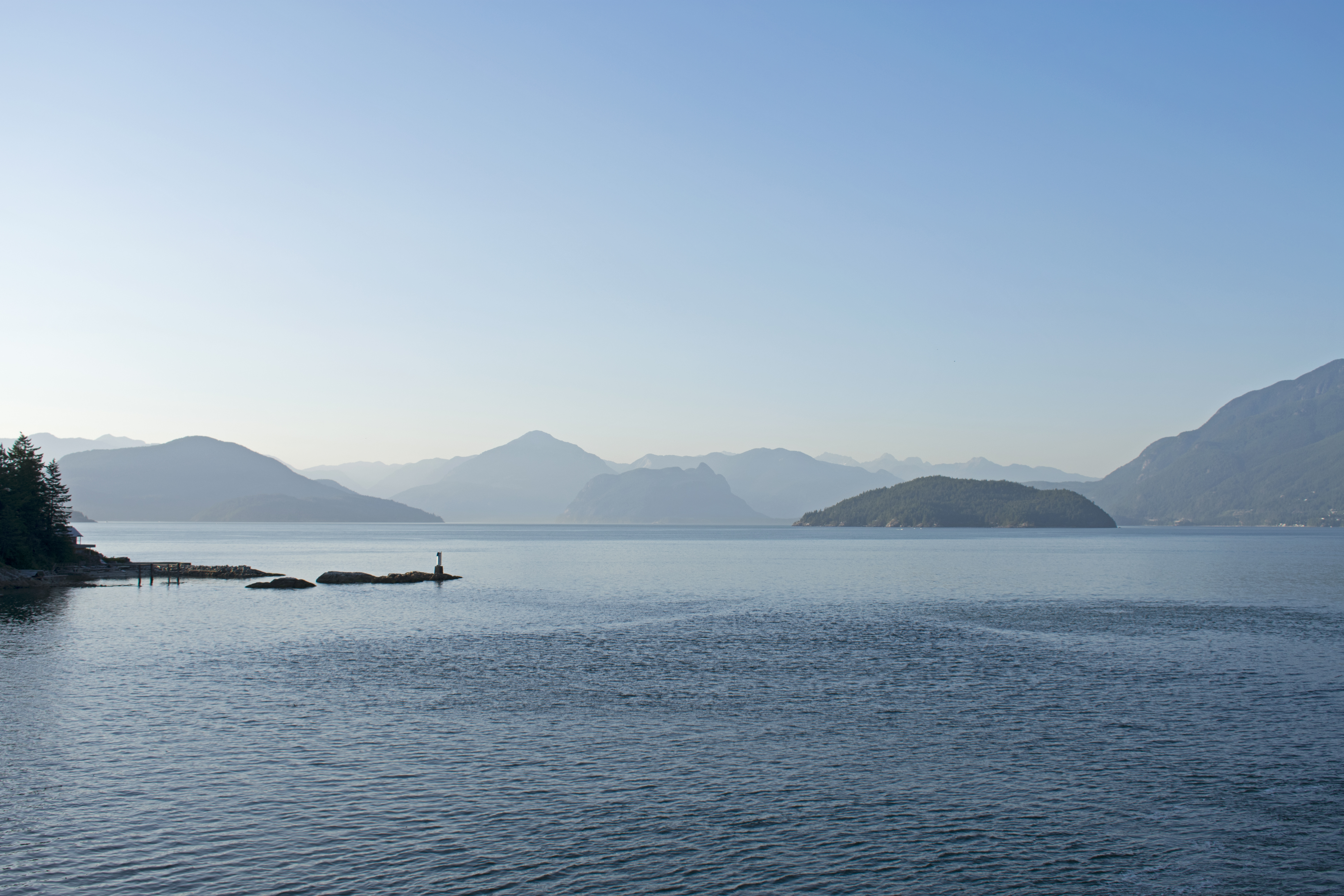
Bowyer Island is a small private island in Howe Sound. It comprises Kildare Estates, Bowyer Island Estates, and B and A Estates. It is located east of Bowen Island and Horseshoe Bay. BC Liberal politician, formerly Attorney-General of British Columbia, Geoff Plant is a seasonal resident. Bowyer Island was named by Capt.
Gallery

Sponsored
Location
1 explorer visited this place

4.3 km
Lions Bay is a small residential community in British Columbia, Canada, located between Vancouver and Squamish on the steep eastern shore of Howe Sound. In the 2021 census the community had a population of 1,390, BC's 36th smallest municipality by population. At 2.53 square kilometres, it is BC's 10th smallest municipality by land area. Originally a boat-access summer camping destination for Vancouverites, Lions Bay began to be permanently settled in the 1960s. The community incorporated as a village municipality in January 1971.

4.5 km
The North Shore Mountains are a mountain range overlooking Vancouver in British Columbia, Canada. Their southernmost peaks are visible from most areas in Vancouver and form a distinctive backdrop for the city.
The steep southern slopes of the North Shore Mountains limit the extent to which the municipalities of Metro Vancouver's North Shore can grow. In many places on the North Shore, residential neighbourhoods abruptly end and rugged forested slopes begin. These forested slopes are crisscrossed by a large network of trails including the Baden-Powell Trail, the Howe Sound Crest Trail, the Binkert/Lions Trail and a wide variety of mountain biking trails.
The North Shore Mountains are a small subrange of the Pacific Ranges, the southernmost grouping of the vast Coast Mountains. They are bounded on the south by Burrard Inlet, on the west and north-west by Howe Sound, and on the north and north-east by the Garibaldi Ranges. To the east the bounds are defined by Indian Arm. The ridge running north from Mount Seymour has its own name, the Fannin Range, while much of the Howe Sound-flanking portion of it is known as the Britannia Range. There is debate whether the Britannia Range is part of the North Shore Mountains as there are no official boundaries of the North Shore Mountains.
Although not particularly high, these mountains are rugged and should not be underestimated. Severe weather conditions in the North Shore Mountains often contrast dramatically with mild conditions in nearby Vancouver. This is especially true in winter, but even in summer, large precipices are hidden very close to popular hiking trails and it is very easy to get lost, despite being in sight of the city. Those who venture into the North Shore Mountains for whatever reason should be well prepared at any time of year.
Three deep river valleys divide the North Shore Mountains. These are, in order from west to east:
Capilano River valley
Lynn Headwaters
Lynn Valley
Lynn Canyon - known for Lynn Canyon Suspension bridge
Seymour River valley
The Capilano and Seymour rivers emanate from the massive Metro Vancouver watershed area administered by Metro Vancouver. The watershed extends deep into the North Shore Mountains region, but is strictly off-limits to all unauthorized human activities. The Lynn Headwaters, a deep cirque valley drained by Lynn Creek, is a very popular regional park administered by Metro Vancouver.
There are two provincial parks in the area, Cypress Provincial Park and Mount Seymour Provincial Park. Both feature reliable road access, downhill ski areas, and extensive trail networks. Nearby Grouse Mountain features a downhill ski area and tourist attractions which are accessible by the Skyride, an aerial tramway. A very popular hiking trail, the Grouse Grind, climbs up the steep flanks of Grouse Mountain from the tramway parking lot. Before the Grouse Mountain Skyride was built, a chairlift operated from Skyline Drive at the head of North Vancouver's Lonsdale Avenue, and the ski area itself could be accessed via Mountain Highway, which now has a gate at its upper end in the Lynn Valley neighbourhood.
In the Seymour River valley, the Lower Seymour Conservation Reserve features over 100 km of trails including a paved bicycle path called the Seymour Valley Trailway that winds into the mountains for 10 km to Seymour Lake. It is frequently used for recreation, and occasionally for TV and film productions such as Stargate SG-1.
4.6 km
Educacentre College is a private French-language college in British Columbia. The general aim is to provide people with bilingual language skills—that speakers of French receive education in their native language and at the same time receive English skills. It provides professional training on different levels, basic education for adults, professional development services, and services leading to the employment and integration of immigrants in French. One major area of work are French courses for English speaking people. The college has several campuses in different regions of the province, and e-learning on the Virtual Campus. It has been active since 1976 and was incorporated as a not for profit society in 1992.
5.2 km
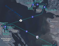
The Bowen Island ferry travels between Snug Cove on Bowen Island, and Horseshoe Bay in the District of West Vancouver, British Columbia, Canada, a trip of three nautical miles across Queen Charlotte Channel. A scheduled ferry has been in operation since 1921, when Bowen Island was a popular holiday destination. Prior to that year, transportation to the island was by steamship from Vancouver, with only one trip daily. The Bowen Island ferry used a fleet of small passenger vessels until 1956, when a single car ferry began passenger service, and that ferry began carrying vehicles in 1958. In 2022 the route carried in excess of 1.2 million passengers plus 570 000 vehicles.
The Bowen Island ferry has no official or common name, and is only numbered as route 8, though this is likely only intended for internal documentation. It is currently run with the use of a single vessel, the Queen of Capilano.

5.4 km
HMCS Annapolis was an Annapolis-class destroyer that served in the Royal Canadian Navy and later, the Canadian Forces. She was the second Canadian naval unit to carry this name. Named for the Annapolis River that flows through Nova Scotia, the ship entered service in 1964, the last of the St. Laurent-class design. Serving through the Cold War, Annapolis was decommissioned in 1998 before going through a protracted legal battle for use as an artificial reef. She was finally scuttled as such in April 2015 in Howe Sound, British Columbia.
George Henry Richards of HMS Plumper between 1857 and 1861, after Rear-Admiral George Bowyer, (1740–1800), commander of HMS Barfleur during the Glorious First of June (all the names used in Howe Sound are in honour of the battle of the Glorious First of June).
