


Le Wharemauku Stream est un cours d’eau du District de Kapiti Coast dans le sud-ouest de l’île du Nord de la Nouvelle-Zélande.
Location
1 explorer visited this place
2.3 km
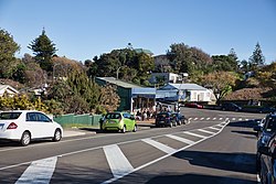
Raumati South is a coastal community on the Kāpiti Coast of New Zealand's North Island. It is 50 km north-west of Wellington, and immediately south of Raumati Beach and south-west of Paraparaumu. The Maungakotukutuku area is located inland.
"Raumati" is the Māori language word for "summer".
In 1912, Herbert and William Eatwell had named the place Kawatiri, but the name was changed to the current one in 1934 because of another place with the same name in the Tasman Region.
To the south of the town, between it and the town of Paekākāriki, is the Queen Elizabeth Park, a 638 hectare regional park used during the filming of The Lord of the Rings: The Return of the King, where it represented Pelennor Fields. Raumati South is known for the large number of its residents pursuing alternative lifestyles and artistic endeavors. The main primary education provider is Raumati South Primary School. There is also a Steiner school called 'Te Rā' located on Poplar Avenue.
6.0 km
Wainui railway station was a flag station between Paekākāriki and Paraparaumu on the Wellington-Manawatu Line in New Zealand, when the line was run by the Wellington and Manawatu Railway Company. This line is now part of the Kāpiti section of the North Island Main Trunk.
The station was opened on 1 December 1886 and served the rural area between Paekākāriki and Paraparaumu. Contemporary newspaper reports state that the station was closed in November 1895, possibly because the land was in the way of a proposed new road.
Cassells states that the station closed on 3 February 1902. The platform was on the west side of the line according to Cassells, who shows a blind siding on the east side of the line with the south end joining the main line.
Hoy however says the station had no buildings or sidings, and was closed in 1900. He says it was north of McKay's Crossing near where a side road crosses the line and went into the hills. According to Hoy, the station apparently served a local Māori community, and closed when the community moved into Paekākāriki.

6.1 km
Mackays Crossing is a locality in the Kāpiti Coast District of New Zealand's North Island, located between Paekākāriki to the south and Raumati South to the north.

7.9 km
Paekākāriki is a town in the Kāpiti Coast District, in the south-west of New Zealand's North Island. The town is part of the Kapiti Coast functional urban area and lies 10 km south of Paraparaumu, 20 km north of Porirua and 41 km northeast of the Wellington CBD. The town's name comes from the Māori language and can mean "parakeet perch". Paekākāriki had a population of 1,674 at the time of the 2023 census, down 72 from the 2018 census.
Paekākāriki lies on a narrowing of the thin coastal plain between the Tasman Sea and the Akatarawa Ranges, and thus serves as an important transportation node. To the south, State Highway 59 climbs towards Porirua; to the north the plains extend inland from the Kāpiti Coast; at Paekākāriki the highway and North Island Main Trunk railway run close together between the coast and hills. Paekākāriki is also served by the nearby Transmission Gully and Kāpiti Expressway.

8.1 km
Steam Incorporated, often abbreviated to Steam Inc., is a railway heritage and preservation society based at the Paekākāriki railway station, Paekākāriki at the southern end of the Kāpiti Coast, approximately 50 minutes north of Wellington on the west coast of New Zealand's North Island. Unlike some societies who operate on preserved sections of closed branch lines, Steam Incorporated owns a depot beside one of the country's most important railway lines, the North Island Main Trunk railway, and restores heritage locomotives and rolling stock for use on excursions on the regular national rail network.