


The Molalla River is a 51-mile (82 km) tributary of the Willamette River in the northwestern part of Oregon in the United States. Flowing northwest from the Cascade Range through Table Rock Wilderness, it passes the city of Molalla before entering the larger river near Canby. The Molalla is the largest Willamette tributary unblocked by a dam.
Gallery


Sponsored
Location
1 explorer visited this place

987 m
The Pudding River is a 62-mile tributary of the Molalla River in Clackamas and Marion counties in Oregon, United States. Its drainage basin covers 528 square miles. Among its tributaries are Silver Creek, Butte Creek, Abiqua Creek, and the Little Pudding River.
Historically, the Pudding River flowed directly into the Willamette River, and aerial photos dating back to 1936 provide evidence of the Willamette River's confluence with the Pudding River mainstem channel. Currently, it flows directly into the Molalla River near River Mile 1 before joining the Willamette River. Anadromous and resident salmonids use the Lower Pudding River main stem and key tributaries that support the basin's ecosystems.

1.6 km
The Molalla River State Park is located in U.S. state of Oregon. It is a few miles north of Canby, and half a mile from the Canby Ferry. The park is south of the Willamette River and east of the Molalla River, at the confluence of the Pudding, Molalla and Willamette rivers. The Pudding River flows into the Molalla from the west, just before the Molalla joins the Willamette. The floodplains of these rivers provide important habitat for waterfowl, wading birds, deer, small mammals, reptiles and amphibians. A blue heron rookery, one of the largest in the Willamette Valley, is located in Molalla River State Park.

2.5 km
The Canby Ferry is a cable ferry in the U.S. state of Oregon that connects Canby, and Wilsonville/Stafford in Clackamas County across the Willamette River. The service has been in operation since 1914, except from 1946 to 1953. The specific vessel used has been replaced and updated several times, most recently in 1997. It is one of three remaining ferries on the Willamette River.
The ferry has room for six cars and a total passenger capacity of 49. A toll is charged for all crossings. As of July 2017, a passenger car costs $5.00, a motorcycle, bicycle, or pedestrian $3.00, and $30.00 is charged if a vehicle takes up the entire ferry. The vessel currently used, the M.J. Lee II, is a cable-guided vessel powered by electricity with a voltage of 460 volts [1] provided by overhead lines and is guided across the river by an underwater cable 1.25 inches in diameter, leaving the vessel relatively unaffected by the river's currents.
The ferry is required by the Navigation Rules to display a day shape and, at night, certain lights that communicate to other vessels its rights on navigable waters.
Because the ferry is guided by an underwater cable, and is fed electricity from an overhead cable, its ability to maneuver is restricted. Such vessels must display the day shape for restricted maneuverability which is a ball, diamond, and ball displayed vertically in the rigging. As the Canby Ferry is permanently with restricted maneuverability, the shipbuilders mounted a metal ball-diamond-ball on a mast. Before sunrise and after sunset, and during periods of restricted visibility, the ferry must display the red over white over red array of a vessel restricted in ability to maneuver.
The ferry is named after Millard Jerome Lee, the first child born in Canby. Lee was born in 1872, two years after the town was platted in 1870. The vessel currently in use, M.J. Lee II, has been providing the service since 1997.
In 2013, operation of the ferry was suspended from January to July, to allow major maintenance work to be carried out. The work included retrofitting the vessel with a new propulsion equipment that is quieter and more energy-efficient – using less electricity – than previously.

2.8 km
Wilsonville High School is a four-year suburban, public high school in Wilsonville, Oregon, United States and is part of the West Linn-Wilsonville School District.
2.9 km
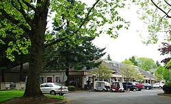
Charbonneau is a private planned community within the city limits of Wilsonville in Clackamas County, Oregon, United States. It is on the opposite side the Willamette River from the main area of the city. The development was named for Jean Baptiste Charbonneau, the son of Sacagawea.
Charbonneau began in 1972 as a nine-hole golf course and 228 town homes; it now has a population of about 3,500 living in 1,158 multi-family units and 510 houses with an integrated 27-hole golf course. There is also a small commercial district with about 10 shops including a grocery store and restaurant. As one of the oldest communities of its type in Oregon, its construction helped lead to the adoption of land-use planning and an urban growth boundary to attempt to prevent urban sprawl.
Charbonneau's 200 primary and secondary students are served by the Canby School District.
Book your tour near
Molalla River
Book Now
4.2
in partnership with
GetYourGuide.com
Book your tour near
Molalla River
Book Now
4.2
in partnership with
GetYourGuide.com
