


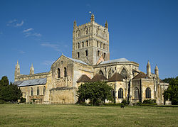
Tewkesbury est un district non-métropolitain et un borough situé dans le comté du Gloucestershire, en Angleterre. Son chef-lieu est la ville éponyme de Tewkesbury.
Location
1 explorer visited this place
0 m
The Borough of Tewkesbury is a local government district with borough status in Gloucestershire, England. The borough is named after its largest town, Tewkesbury where the council is based. The district also includes the town of Winchcombe and numerous villages including Bishops Cleeve, Ashchurch, Churchdown, Innsworth and Brockworth as well as other hamlets and surrounding rural areas. Parts of the district lie within the Cotswolds Area of Outstanding Natural Beauty.
The neighbouring districts are Cotswold, Cheltenham, Stroud, Gloucester, Forest of Dean, Malvern Hills and Wychavon.

285 m
The Mythe Water Treatment Works in Tewkesbury, Gloucestershire, England, is a water purification facility that treats water drawn from the River Severn for public consumption.
On 1 March 2002, Severn Trent Water worked with local councillors to create an emergency plan that was supposed to ensure that in a state of emergency their services would not be affected.
It came to national attention in July 2007 when it became inundated with water from the River Severn during the Summer 2007 United Kingdom floods. The water coming into the plant was contaminated, and this led to the loss of tap water for approximately 150,000 people in Cheltenham, Gloucester and Tewkesbury.
Following the flooding, a variety of measures have been taken, including a 3.5 metres high wall, to reduce the likelihood of recurrence.

311 m
Mythe Bridge carries the A438 road across the River Severn at Tewkesbury. It is a cast-iron arch bridge spanning 170 feet and 24 feet wide, designed by Thomas Telford and completed in April 1826. It is a Grade II* listed structure.
With authorisation given by the Tewkesbury Severn Bridge and Roads Act 1823, Telford was appointed to design the bridge in 1823, following a dispute between the bridge trustees and their existing architect, who had proposed a bridge with three shorter iron arches. Telford changed the scheme to a single span so as to reduce interference with navigation of the river, and also to eliminate the expense of constructing foundations in the river gravels.
Like Telford's Craigellachie Bridge, Mythe Bridge was cast by William Hazledine, and is similar in form to Telford's Galton Bridge, which spans the Birmingham Canal at Smethwick. It has six cast iron ribs, each cast in 23-foot lengths, with spandrels filled with X-shaped bracing. Telford described the iron as "best Shropshire iron, commonly called No. 2"'. The arch rises 17 feet, one tenth of the span. The X-bracing carries the diagonal crossed bracing to the spandrels beneath the beam, as well as to the carriageway and balustrade. The abutments at either end of the bridge houses a group of six tunnel vaults with pointed arches and stone quoins. These are separated by the attached colonnettes. Hugh McIntosh was contractor for the embankment and abutments.
The total cost of the bridge including masonry approaches was £14,500, It was originally a toll bridge, but tolls were removed in 1850. An Ordnance Survey map of 1884 shows a toll booth at either end of the bridge.
Telford wrote:
I reckon this the most handsomest bridge which has been built under my direction ...
The bridge was designated a Grade II* listed building on 4 March 1952, the reason for listing it being that it is of "technological interest as a bridge of iron construction with a 52m span designed in the early 1820s, part of the first generation of this technologically significant type of bridge" and because of its "engineering interest as a significant bridge built by Thomas Telford." Historic England has placed the bridge on the Heritage at Risk register.
In 1923, the decking was strengthened by adding a reinforced concrete slab. In 1990, tests showed the bridge was too weak for many heavy goods vehicles, and traffic was limited to a 7.5 ton maximum. This was increased to 17 tons after the bridge had been strengthened in 1992. The secondary members needed strengthening and this was effected by enhancing the shear strength of the transverse cross beams by bonding steel plates to the web of the cross beams. The longitudinal cross-bracing was strengthened by using angle splints and the space between the splints and the cross-bracing was grouted. Additional transverse bracing was supplied by reinforcing the central spine of the arch, with one end bolted to steel sleeves, and the other end bolted to the cross beams at the top of the arch.

459 m
The River Avon in central England flows generally southwestwards and is a major left-bank and easternmost tributary of the River Severn. It is also known as the Warwickshire Avon or Shakespeare's Avon, to distinguish it from several other rivers of the same name in the United Kingdom.
Beginning in Northamptonshire, the river flows through or adjoining the counties of Leicestershire, Northamptonshire, Warwickshire, Worcestershire and Gloucestershire, near the Cotswold Hills area. Notable towns it flows through include Rugby, Warwick, Stratford-upon-Avon, Evesham, Pershore and Tewkesbury, where it joins the Severn. It has traditionally been divided since 1719 into the Lower Avon, below Evesham, and the Upper Avon, from Evesham to above Stratford-upon-Avon.
Improvements to aid navigation began in 1635, and a series of locks and weirs made it possible to reach Stratford, and to within 4 miles of Warwick. The Upper Avon was tortuous and prone to flooding, and was abandoned as a means of navigation in 1877. The Lower Avon struggled on, and never really closed, although by 1945 it was only navigable below Pershore. Restoration of the lower river as a navigable waterway began in 1950, and was completed in 1962. The upper river was a more daunting task, as most of the locks and weirs were no longer extant. Work began in 1965 on the construction of nine new locks and 17 miles of river, using mainly volunteer labour, and was completed in 1974 when it was opened by Queen Elizabeth the Queen Mother.
The Avon connects with the Stratford-upon-Avon Canal in the centre of Stratford, and is used primarily by leisure craft. Plans to extend the navigable river to provide a link with the Grand Union Canal at either Warwick or Leamington Spa have met with some opposition.

462 m
The Mythe Chapel is located at Tewkesbury on the Mythe. The Mythe Chapel was the only place of worship on the Mythe after the Dissolution.
The chapel was built in 1870 with funds from the Marquis de Lys who had lived in Tewkesbury since 1863. An old group of stables originally occupied the site and were partly incorporated into the new building to which windows, niches and buttresses were added.
The re-awakening of Catholicism in Tewkesbury was signalled by an anonymous notice in the Laity Directory of 1834. It read. “A gentleman, in the neighbourhood, is willing to assist in establishing a chapel in Tewkesbury, when this desirable object can be entered upon with a probability of success”.
The Mission was established in 1870. The first Missioner was Father Thomas William Fenn, D.D. who remained at Tewkesbury until his retirement in June 1905. The first St Joseph's Church opened at the Mythe on Saint Joseph's Day, 19 March 1870. Vicar General, Mgr Bonomi, performed the ceremony. On 8 December 1870 Pope Pius IX declared St Joseph to be Patron of the Universal Church. In 1977 the present St Joseph's Church, formerly a telephone exchange erected in 1938, was opened for Catholic worship and the old church at the Mythe was deconsecrated. The original stained glass windows were removed and relocated to the new facility. The Mythe Chapel was used for industrial purposes before being converted into residential housing by Peter and Wendy Vose between 1988 and 1990. The old presbytery was converted into September House and the main chapel was converted into a pair of cottages retaining the original oak beams and carved oak chapel door as interior features.