


La chapelle Sainte-Lutgarde (dite « Chapelle de verre ») est un ancien édifice religieux catholique sis à Fauquez, un hameau de la commune d’Ittre dans le Brabant wallon, en Belgique. Elle est construite en 1929 comme chapelle privée pour les ouvriers des verreries de Fauquez ; sa décoration, intérieure comme extérieure, est dominée par la marbrite, un matériau produit à Fauquez même.
Gallery


Sponsored
Location
1 explorer visited this place

1.7 km
The Brussels–Charleroi Canal, also known as the Charleroi Canal amongst other similar names, is an important canal in Belgium. The canal is quite large, with a Class IV Freycinet gauge, and its Walloon portion is 47.9 kilometres long. It runs from Charleroi in the south to Brussels in the north.
The canal is part of a north–south axis of water transport in Belgium, whereby the north of France including Lille and Dunkirk and important waterways in the south of Belgium including the Sambre valley and the sillon industriel are linked to the port of Antwerp in the north, via the Brussels–Scheldt Maritime Canal, which meets the Brussels–Charleroi Canal at the Sainctelette area of Brussels.
The Ronquières inclined plane is the canal's most remarkable feature and a tourist site.
1.7 km
Ronquières is a village of Wallonia and a district of the municipality of Braine-le-Comte, located in the province of Hainaut, Belgium.
It is best known as the location of the Ronquières inclined plane on the Brussels-Charleroi Canal. The lower end of the inclined plane is just a few hundred metres from the centre of the village.
The population of the village was 1370 as of January 2006.

2.9 km
The Ronquières Inclined Plane is a canal inclined plane on the Brussels-Charleroi Canal in the province of Hainaut in Wallonia, Belgium. It opened in April 1968 having taken six years to build. It is in the municipality of Braine-le-Comte and takes its name from the nearby village of Ronquières.
The plane was built to reduce the delays imposed by the 14 locks that had hitherto been needed for the canal to follow the local topography.

4.1 km
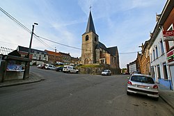
Ittre is a municipality of Wallonia located in the Belgian province of Walloon Brabant. Since the fusion of the Belgian municipalities in 1977, the municipality is composed of three districts: Haut-Ittre, Ittre and Virginal-Samme.
Ittre was the geographical center of Belgium until World War I. The geographical center was moved to Walhain due to the allocation of the East Cantons to Belgium.

5.9 km
Weerde is a railway station in the town of Weerde, Flemish Brabant, Belgium. The station opened on 1 January 1864 on the Lines 25 and 27. The train services are operated by National Railway Company of Belgium.
Désaffectée en 1984, la chapelle est aujourd’hui utilisée pour des activités culturelles.