


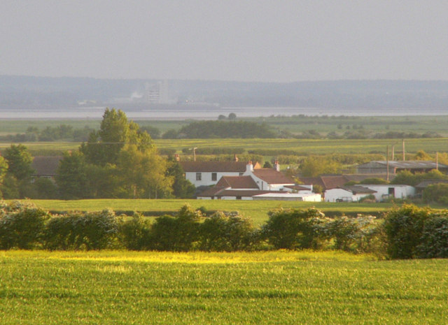
Weeton is a hamlet in the East Riding of Yorkshire, England, in an area known as Holderness. It is situated approximately 1 mile (1.6 km) south-east of the village of Welwick on the B1445 road from Patrington to Easington. It forms part of the civil parish of Welwick.
Location
1 explorer visited this place

1.4 km
Welwick is a village and civil parish in the East Riding of Yorkshire, England, in an area known as Holderness. It is situated approximately 4 miles south of the town of Withernsea and 2 miles south-east of the village of Patrington on the B1445 road from Patrington to Easington.
The civil parish is formed by the village of Welwick and the hamlet of Weeton. According to the 2011 UK census, Welwick parish had a population of 297, a reduction on the 2001 UK census figure of 307.
The name Welwick derives from the Old English wellawīc meaning 'trading settlement by a spring'.
In 1823 Welwick inhabitants numbered 410, including the settlements of Thorpe Plewland and Weeton. Occupations included eleven farmers, three shoemakers, two blacksmiths, two wheelwrights, a corn miller, a butcher, a tailor, a grocer who was also a draper, and the landlady of the Wheat Sheaf public house. There existed a Quaker Meeting House and a Methodist chapel. Baines' History, Directory & Gazetteer of the County of York mentions an ancient and "grand" monument within St Mary's Church supposedly removed from Burstall Abbey, and perhaps a memorial to either John de Fortibus or William le Gros, Earl of Albemarle. Welwickthorpe, in the parish of Welwick lay between the village and Patrington.
The parish church of St Mary is a Grade I listed building.
A sand and gravel pit was established in the south-west of the parish in the 1930s, located parallel and south of Pant Drain, the site's development was driven by the 1930s building boom. The extracted material, which lay less than 1 foot below the ground, was washed and grade separated on site by a rotary screen. By 1938 a rail tramway had been built to transport the excavated material to the main road – the line ran southwards from the midpoint of the B1445 between Welwick and Patrington, passing west of Haverfield House, to Oxlands Hill, and used a diesel shunting locomotive capable of hauling 120 tons; the material was transported in short wheelbase side tipping wagons.

1.6 km
St Mary's Church is an Anglican parish church in the English village of Welwick in the East Riding of Yorkshire. It is a Grade I listed building.

1.8 km
Skeffling is a village and civil parish in the East Riding of Yorkshire, England, in an area known as Holderness. It is situated approximately 5 miles south of the town of Withernsea and 4 miles south-east of the village of Patrington on the B1445 road from Patrington to Easington.
According to the 2011 UK census, Skeffling parish had a population of 149, a decrease on the 2001 UK census figure of 153.
The Church of St Helen is a Grade I listed building that is situated to the south of the village. It is constructed of cobble with stone dressings and was built in the 1460s.

1.9 km
Birstall Priory or Burstall Priory was a priory in the East Riding of Yorkshire, England. The priory was built around 1219 and continuing as an inhabited religious house until the Dissolution of the Monasteries between 1536 and 1541. Burstall Bank and Burstall Lane are still in existence near the north bank of the Humber Estuary, south of Skeffling, but Birstall Priory itself has long since been given up to the sea.

2.0 km
St Helen's is a redundant church in the village of Skeffling, Holderness, in the East Riding of Yorkshire, England. Dating from the mid-15th century, the church was dedicated to St Helena. It is recorded in the National Heritage List for England as a designated Grade I listed building and is under the care of the Friends of Friendless Churches.