Location Image

Rutherglen Bridge

The Rutherglen Bridge or the Shawfield Bridge is a bridge which was built 1893–96, which crosses the River Clyde, in Scotland. It connects Shawfield, the most northerly district in the town of Rutherglen, and the south-side Glasgow district of Oatlands, with the Glasgow East End districts of Dalmarnock, Glasgow Green and Bridgeton. Bridgeton is in fact named after the first bridge at the site that was constructed in 1776 and designed by James Watt, which stood until 1890. The road is part of the Glasgow East End Regeneration Route running between the M8 and M74 motorways. The Glasgow side of the bridge is a convenient point for walkers and cyclists to join the Clyde Walkway or National Cycle Route 75 which share a tarmac path along the river at this point. It should not be confused with the nearby Dalmarnock Bridge which also connects Rutherglen to Dalmarnock, nor with a modern pedestrian 'Smartbridge' between Shawfield and Dalmarnock.

Nearby Places View Menu
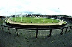
Location Image
284 m

Shawfield Stadium

Shawfield Stadium is a venue in the Shawfield district of the town of Rutherglen, South Lanarkshire, Scotland, located close to the boundary with Glasgow. Originally a football ground, Shawfield was home to Clyde F.C. from 1898 to 1986. Greyhound racing was introduced in 1932, and the stadium hosted the Scottish Greyhound Derby from 1970 to 1985 and from 1989 to 2019. The Glasgow Tigers speedway team were also based there, from 1988 to 1995 and 1997 to 1998, with the Scottish Monarchs also racing there in 1996. Other sports including boxing and athletics were also staged at Shawfield. On 19 March 2020, an announcement was made to suspend racing because of the COVID-19 pandemic. In the following two years the majority of trainers moved their greyhounds to other venues as the track became derelict. During October 2022, the stadium's owner Billy King died, ending the likelihood of it ever reopening.
387 m

Barrowfield Park

Barrowfield Park was a football ground in the Bridgeton / Dalmarnock area of Glasgow, Scotland. It was the home ground of Eastern during the 1870s and Clyde between 1877 and 1898.
Location Image
421 m

Oatlands, Glasgow

Oatlands is an area in the city of Glasgow, Scotland. It is situated south of the River Clyde, falls within the Southside Central ward under Glasgow City Council, and is part of the Gorbals historic area. Its boundaries are Hutchesontown and the Southern Necropolis cemetery to the west, Polmadie to the south (across the M74 motorway and West Coast Main Line railway), Shawfield (part of the town of Rutherglen) to the east, and Glasgow Green public park to the north (across the River Clyde). Oatlands is connected to the Green via Polmadie Bridge which was dismantled in 2015 due to structural safety concerns and replaced in 2018.
Location Image
517 m

Polmadie Bridge

The Polmadie Bridge is a footbridge that crosses the River Clyde, Glasgow, Scotland between Glasgow Green (the Flesher's Haugh area which is largely football pitches) to its north, and Oatlands (at the west side of Richmond Park) to its south.