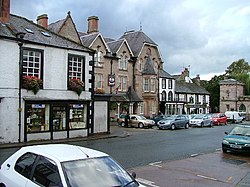
Burrells is a hamlet in the civil parish of Hoff, in the Westmorland and Furness district of the ceremonial county of Cumbria, England, located just south of Appleby-in-Westmorland on the B6260. Historically a township in the Parish of Appleby in Westmorland, the hamlet contains both the Grade II listed Burrells House (early 19th century), as well as its Grade II listed barn, rebuilt in 1818. The now disused Hoff Quarry was an important local source of stone known geologically as Brockram, a breccia of cemented limestone and sandstone fragments dating from the Permian period. From 1974 to 2023, Burrells was in the Eden district, before the Eden District Council was abolished and its functions transferred to Westmorland and Furness. There is no Church of England parish church in the civil parish of Hoff. Like the rest of the civil parish, Burrells is within the ecclesiastical parish of Appleby St Lawrence.

Nearby Places View Menu
Location Image
834 m

Hoff, Cumbria

Hoff is a hamlet and civil parish in the unitary authority area of Westmorland and Furness and the ceremonial county of Cumbria, in England. The hamlet of Hoff lies some 3 kilometres (1.9 mi) south-west of the town of Appleby-in-Westmorland. It consists of a number of a number of houses and a pub, The New Inn, which re-opened in 2011 after a number of years of closure. There is also a postbox and, formerly, a pioneering solar-powered lamppost. The name Hoff originates from old Norse and means 'a heathen sanctuary or temple'. The civil parish of Hoff includes, as well as Hoff itself, the hamlets of Drybeck and Burrells. At the 2001 census the parish had a population of 189, decreasing to 164 at the 2011 Census. There is no Church of England parish church in either the hamlet or civil parish of Hoff. Both are within the ecclesiastical parish of Appleby St Lawrence. Hoff Beck forms on the southern border of the parish, with the confluence of Scale Beck and Asby Beck, and flows through both parish and hamlet. Between the confluence and Hoff hamlet, the beck flows over Rutter Force, a 30-foot (9.1 m) high waterfall.
Location Image
1.8 km

Appleby Castle

Appleby Castle is in the town of Appleby-in-Westmorland overlooking the River Eden (grid reference NY685200). It consists of a 12th-century castle keep which is known as Caesar's Tower, and a mansion house. These, together with their associated buildings, are set in a courtyard surrounded by curtain walls. Caesar's Tower and the mansion house are each recorded in the National Heritage List for England as a designated Grade I listed building. The uninhabited parts of the castle are a scheduled ancient monument.
Location Image
2.1 km

Moot Hall, Appleby-in-Westmorland

The Moot Hall is a municipal building in Boroughgate, Appleby-in-Westmorland, Cumbria, England. The building, which is currently used as the meeting place of Appleby-in-Westmorland Town Council, is a Grade II* listed building.
Location Image
2.2 km

Appleby-in-Westmorland

Appleby-in-Westmorland is a market town and civil parish in Westmorland and Furness, Cumbria, England, with a population of 3,048 at the 2011 Census. Crossed by the River Eden, Appleby is the county town of the historic county of Westmorland. It was known just as Appleby until 1974–1976, when the council of the successor parish to the borough changed it to retain the name Westmorland, which was abolished as an administrative area under the Local Government Act 1972, before being revived as Westmorland and Furness in 2023. It lies 14 miles (23 km) south-east of Penrith, 32 miles (51 km) south-east of Carlisle, 27 miles (43 km) north-east of Kendal and 45 miles (72 km) west of Darlington.