
 English
 Français

Épée de Gilling
L'épée de Gilling (Gilling sword en anglais) est une arme anglo-saxonne du IXe siècle. Découverte en 1976 à Gilling West, dans le Yorkshire du Nord, elle est exposée au Yorkshire Museum.
Nearby Places View Menu

131 m
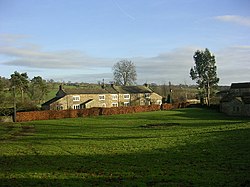
Gilling West
Gilling West is a village about 3.5 miles (5.6 km) north of Richmond in North Yorkshire, England. It is located in the civil parish of Gilling with Hartforth and Sedbury. It is named "West" to distinguish it from Gilling East near Helmsley, some 32 miles away.
A 2018 report states that the community houses people who commute to Darlington, Teesside and Richmond via the A66 and A1(M). The settlement "retains a village hall, two public houses and a shop but there is no longer a post office. There is a limited bus service to the village." The report adds that Gilling West is a Conservation Area with the High Street of particular significance. "A substantial percentage of the buildings [in the community] are listed as being of special architectural or historic interest".

175 m
St Agatha's Church, Gilling West
St Agatha's Church is an Anglican church in Gilling West, a village in North Yorkshire, in England.
The church was originally built in the late 11th century, as a small rectangular building with a west tower. In the 14th century, the nave was altered, and a vestry was added on the north side of the chancel. Around this time, a new chancel arch and south aisle were added, followed later in the century by a north aisle. The tower was heightened in the late 15th century, when the windows were also altered. In 1845, the church was restored by Ignatius Bonomi and John Augustus Cory, who added a second north aisle and a stair turret. The building was grade I listed in 1969.
The church is built of stone and has roofs of Welsh slate, stone slate and lead. It consists of a nave with a clerestory, a south aisle, a south porch, inner and outer north aisles, a chancel with a north vestry, and a west tower. The tower has three stages, a five-sided south stair turret with a pyramidal roof, chamfered bands, a three-light west window, a clock face on the east side, straight-headed bell openings, an embattled parapet, and a central weathercock. In the porch are several pre-Conquest carved stones and some later Mediaeval stones, including a grave cover. The nave roof is 15th century, while most of the fittings are 19th century. There is a black marble monument to Henry and Isabelle Boynton, dating from about 1531, and assorted 18th- and 19th-century wall monuments.
1.2 km
Scot's Dyke
Scot's Dyke, also known as the Scots Dyke or the Scots Dike, is a linear earthwork in the district of Richmondshire in the county of North Yorkshire, England. It is about fourteen kilometres (8.7 miles) long and runs from the river Swale to the river Tees.
Camden in Britannia says:
“and neere at hand there is seene a ditch by Stanwig a little village, that runneth eight miles in length betweene the river Tees and Swale.”
The Scot's Dyke varies in size and form throughout its length, which show that each section was built by a separate group of workers. South of the A66 road the dyke had a bank up to 1.5 metres (4 ft 11 in) high and 10m wide with a ditch 7 metres (23 ft) wide and 1 metre (3 ft 3 in) deep. On the eastern side of the ditch traces could be seen of a counterscarp bank approximately 5m wide.
Parts of the dyke are possibly a double dyke (two banks with a ditch in the middle) as shown by the Ordnance Survey maps at the northern end of the dyke. A link with the earthworks of the oppidum at Stanwick near the northern end of the dyke would make sense but there is no evidence of this.
Excavations in advance of the A66 road improvements in 2006-2007 gave an opportunity for the dyke to be investigated. No artefacts were recovered from the excavation and the relationship between the Scot's Dyke and the Roman road was not established but samples of the ditch fills were taken for dating:
“Archaeomagnetic dating of sediment fills from Scots Dyke in 2006 provided results suggesting that the feature was starting to fill up in the period from the first century BC to the first century AD.”
The Scot's Dyke should not be confused with the Scots' Dike that marks part of the border between England and Scotland.

1.4 km
Gillingwood Hall
Gillingwood Hall is a historic building in Gilling West, a village in North Yorkshire, in England.
The first Gillingwood Hall was a country house, built by the Wharton family in the early 17th century. It was partly rebuilt in the mid 18th century, possibly to the designs of Daniel Garrett. The house burned down in 1750, although various outbuildings survived. In about 1800, a farmhouse was built on the site, also named "Gillingwood Hall". The farmhouse was grade II listed in 1969.
The farmhouse is built of stone, with a T-shaped plan. The main block has two storeys, three bays, and a stone slate roof with stone coping. It has a sill band, and in the centre is a re-used doorcase with an architrave and a fanlight, over which is a blank panel, and a pediment on consoles, and in the upper floor are sash windows. To the right is a lower two-storey bay that has a pantile roof with stone slates at the eaves. Further to the right is a single-storey bay, and at the rear is a wing on the right.
The front doorway of the old hall survives, set into a wall. It has a rounded arch, and an archivolt rising from capitals. This is surrounded by fluted Roman Doric engaged columns, and a Doric entablature with guttae, triglyphs, metopes with paterae, and mutules with an acanthus motif, surmounted by a pediment. The stone wall extends for about 1 metre (3 ft 3 in) on each side, and part of a window survives in the right wall. The structure is grade II listed.
1.6 km
Hartforth
Hartforth is a small village in the county of North Yorkshire, England. The village is situated approximately 9 miles (14 km) south-west from the market town of Darlington, and is part of the civil parish of Gilling with Hartforth and Sedbury. The population was 558 at the 2021 census.
From 1974 to 2023 it was part of the district of Richmondshire, it is now administered by the unitary North Yorkshire Council.
Hartforth Hall is a Grade II* listed country house. It was built in 1744 for William Cradock of Gilling, who had bought the manor of Hartforth in 1720. Additions were made in 1792 and c. 1900.