


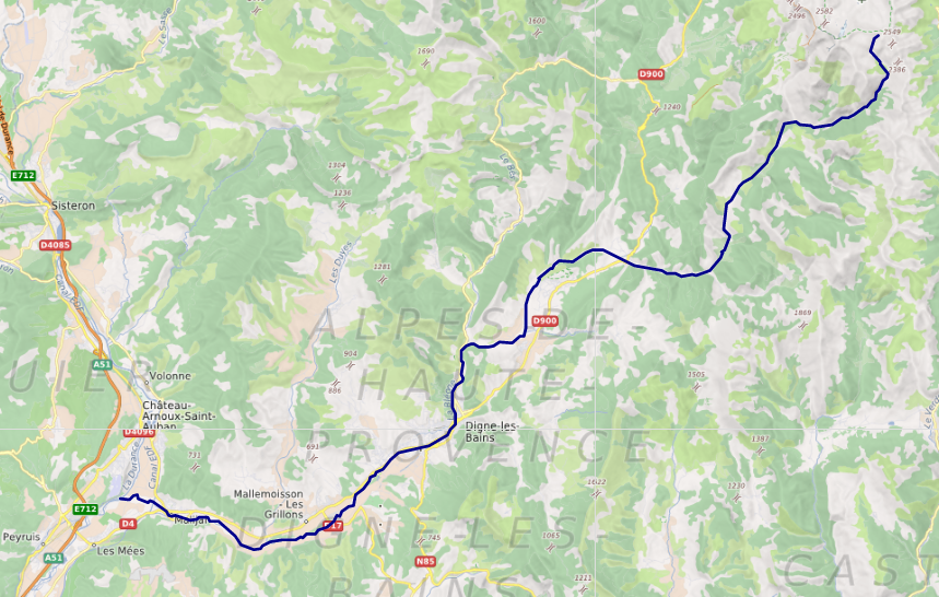
The Bléone (French pronunciation: [bleɔn]; Occitan: Blèuna) is a 69.5-kilometre (43.2 mi) long river in the Alpes-de-Haute-Provence département, southeastern France. Its drainage basin is 906 km2 (350 sq mi). Its source is several small streams converging near the refuge de l'Estrop, a mountain shelter in Prads-Haute-Bléone. It flows generally southwest. It is a left tributary of the Durance into which it flows between L'Escale and Les Mées.
Book your tour near
Bléone
Book Now
4.1
in partnership with
GetYourGuide.com
Gallery

Sponsored
Location
1 explorer visited this place

824 m
Château-Arnoux-Saint-Auban Airport is an airport located 4 kilometres south-southwest of Château-Arnoux-Saint-Auban, in the Alpes-de-Haute-Provence département of the Provence-Alpes-Côte d'Azur region in France.
A campus of the École nationale de l'aviation civile is located on the aerodrome.

2.3 km
Montfort is a commune in the Alpes-de-Haute-Provence department in southeastern France.

2.8 km
Malijai is a commune in the Alpes-de-Haute-Provence department in southeastern France. In 1974, it absorbed the former commune Chénerilles.

2.9 km
Les Mées is a commune in the Alpes-de-Haute-Provence department in southeastern France.
2.9 km
The canton of Les Mées is a former administrative division in southeastern France. It was disbanded following the French canton reorganisation which came into effect in March 2015. It had 11,795 inhabitants.
The canton comprised the following communes:
Le Castellet
Entrevennes
Malijai
Les Mées
Oraison
Puimichel
Book your tour near
Bléone
Book Now
4.1
in partnership with
GetYourGuide.com