
 English
 Français
River Ruel
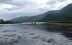
River Ruel is a watercourse in Argyll and Bute, Scotland. Around 9 miles (14 km) long, it flows into Loch Ruel (also known as Loch Riddon). The river passes settlements such as Clachan of Glendaruel and Ormsdale.
Nearby Places View Menu

1.6 km
Creag Tharsuinn
Creag Tharsuinn (643 m) is a mountain in the Arrochar Alps of Scotland. It lies in the Cowal peninsula, Argyll and Bute.
Taking the form of a long ridge, the peak rises steeply above the surrounding glens. It is usually climbed from Garvie in Glendaruel. The nearest village is Kilmodan.

3.1 km
Beinn Mhòr (Cowal)
Beinn Mhòr is the highest mountain on the Cowal Peninsula, west of Loch Eck in Argyll and Bute, west of Scotland. It has a high topographic prominence to height ratio and consequently commands a good all round view.
Beinn Mhor is within the Loch Lomond and The Trossachs National Park. To its east, Benmore Botanic Garden makes use of the lower slopes, and includes an outdoor centre in Benmore House.

4.8 km
Dunans Bridge
Dunans Bridge is a category A-listed structure, designed by Thomas Telford. It is located at Dunans Castle on the Cowal peninsula in Argyll, Scotland. It was built for John Fletcher of Dunans, to commemorate the battle of Waterloo. The bridge was completed in 1815, and predates the 1864 elaboration of Dunans House by Kerr into a Franco-Baronial "castle". The three-arched rubble construction is considered internationally important as it is the only extant bridge of this type. It stands over 15 metres (49 ft) from the river bed and has been voted one of Scotland's ten best bridges. It was built to replace the now destroyed "swing bridge". Though it is of a kind often constructed by Telford, the three arches, gargoyles and eight hexagonal piers, as well as its sheer height 16 metres (52 ft), make it unique.
The structure is in the "RESTORATION IN PROGRESS" category on the Buildings at Risk Register for Scotland. The 2023 update indicates: "North face was repointed last year, repairs to the eastern arch commence late 2023. Further works into 2024-5 are scheduled, including the repointing of the main arch."

5.3 km
River Cur
The River Cur is a river on the Cowal Peninsula, in Argyll and Bute, west of Scotland. The position of its source is uncertain, as it is formed from a large number of small burns; for example, one of these rises on the slopes of Cruach nam Mult, at grid reference NN165056 and an elevation of about 2,000 feet (600 m). The river flows south-west until it reaches the head of a glacial valley near Strachur, Loch Fyne. (For a short distance it forms the boundary of the Argyll Forest Park, which it soon enters.) The river does not enter Loch Fyne, but instead turns south-east. At that point it has reached an elevation of only about 160 feet (50 m), and it continues along the valley, losing altitude much more slowly, until it reaches the head of Loch Eck. Before reaching Loch Eck, it passes near the tiny settlements of Balliemore and Invernoaden and Glenbranter.