


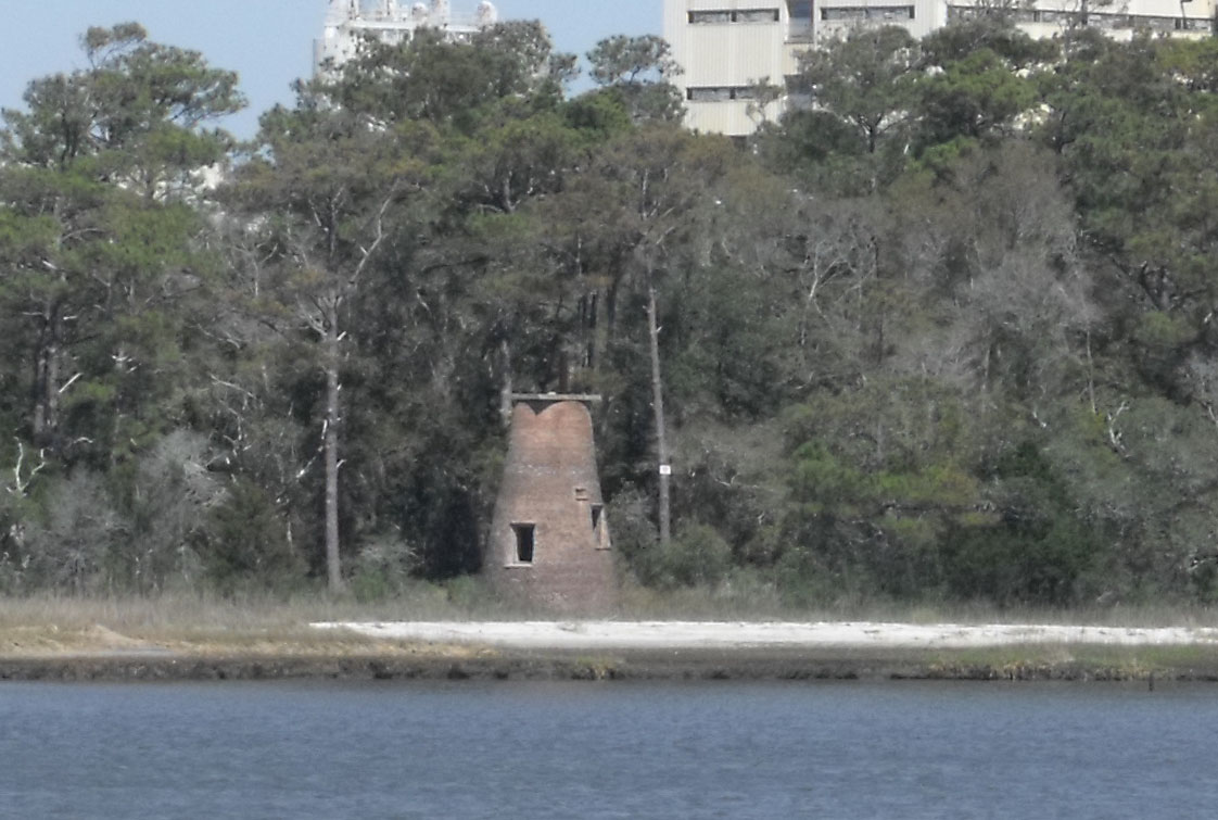
The Price Creek Lighthouse, also known as the Price's Creek Lighthouse, is a structure located near Southport, North Carolina. It was one of two range lights at Price Creek in a series of lights to guide ships from Cape Fear to Wilmington, North Carolina.
Gallery

Sponsored
Location
1 explorer visited this place

3.1 km
The Brunswick nuclear power plant, named for Brunswick County, North Carolina, covers 1,200 acres at 20 feet above sea level about 5 miles from the Atlantic Ocean. The site is adjacent to the town of Southport, North Carolina, and to wetlands and woodlands, and was opened in 1975.
The site contains two General Electric boiling water reactors, which are cooled by water collected from the Cape Fear River and discharged into the Atlantic Ocean.
Duke Energy Progress is the majority owner and operator of the Brunswick nuclear plant. The North Carolina Eastern Municipal Power Agency owns the remaining 18.3%. In 2015, Duke Energy completed the process of buying the North Carolina Eastern Municipal Power Agency's 18.3% stake at Brunswick nuclear power plant.
The Brunswick plant's original design called for two cooling towers, and construction of the foundations for both towers was started. However, the proximity to the Cape Fear River and the Atlantic Ocean allowed the designers to take in cooling water from the Cape Fear river and discharge it into the Atlantic off the coast of Oak Island. Fish, crustaceans, and other debris are removed from the cooling water via a filtration system. The water then flows through the nuclear plant and discharges into a five mile long canal which passes under the Intra-Coastal Waterway at one point. The concrete foundation of one unfinished cooling tower is now a parking lot for employees at the plant.

4.6 km
Corncrake Inlet was a historical located on the Cape Fear region in the Brunswick County of North Carolina just south of Federal Point. The Channel is now closed and the original coordinates for Corncrake Inlet placed it within the 28461 ZIP Code delivery area, and the approximate elevation is unknown above sea level. The presence of this channel dates back to 1938.
Coordinates: 33.9190632°N, -77.9444314°W
Category: North Carolina physical, cultural and historic features
On September 7, 1995, rip currents produced by Hurricane Luis caused the death of one person near Corncrake Inlet, North Carolina.[1] High waves and high tides, caused significant beach erosion and coastal flooding. In Brunswick County, eight homes were washed away by the waves, and 40 feet of the beach was lost. Total losses in North Carolina amounted to approximately $1.9 million.
Since then, the entire coastal plain of the east coast has experienced a constant rise in sea level and rose dramatically between 2011 and 2015.
In 1998, Corncrake Inlet was officially shoaled and closed due to the damages of Hurricane Bonnie.
Before Corncrake Inlet was closed, it was noted as a shad fishing location.

5.9 km
Fort Fisher State Recreation Area is a 287-acre North Carolina state park in New Hanover County, North Carolina in the United States. Located near Kure Beach, North Carolina, it includes Fort Fisher, site of a major naval engagement during the American Civil War. The recreation area also served as a home for the Fort Fisher Hermit, Robert Harrill. Harrill lived in a bunker and shared his beliefs about "common sense" with thousands of visitors every year while surviving on what he could gather from the surrounding salt marsh and oyster beds.
Today, the recreation area consists of the remains of the earthen Fort Fisher and a museum at Fort Fisher State Historic Site, an oceanfront beach pavilion, a large lagoon popular with windsurfers, and a long stretch of beach that is accessible only by four-wheel drive vehicles. The beach is an important nesting ground for sea turtles, and state park rangers regularly patrol the beach to identify recently built turtle nests. Once they are identified, they are clearly marked and surrounded with a mesh fence to prevent vehicles from driving over the eggs. The openings in the mesh are large enough to allow newly hatched turtles to pass through and return to the sea.
The endangered Piping Plover and the Peregrine Falcon are other endangered species found in the area.

7.6 km
Fort Fisher was a Confederate fort during the American Civil War. It protected the vital trading routes of the port at Wilmington, North Carolina, from 1861 until its capture by the Union in 1865. The fort was located on one of Cape Fear River's two outlets to the Atlantic Ocean on what was then known as Federal Point or Confederate Point and today is known as Pleasure Island. The strength of Fort Fisher led to its being called the Southern Gibraltar and the "Malakoff Tower of the South". The battle of Fort Fisher was the most decisive battle of the Civil War fought in North Carolina.

7.7 km
The Second Battle of Fort Fisher was a successful assault by the Union Army, Navy and Marine Corps against Fort Fisher, south of Wilmington, North Carolina, near the end of the American Civil War in January 1865. Sometimes referred to as the "Gibraltar of the South" and the last major coastal stronghold of the Confederacy, Fort Fisher had tremendous strategic value during the war, providing a port for blockade runners supplying the Army of Northern Virginia.