
 English
 Français

Thornton Watlass
Thornton Watlass est un village et une paroisse civile du Yorkshire du Nord, en Angleterre.
Nearby Places View Menu
0 m
Thornton Watlass
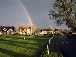
Thornton Watlass is a small village and civil parish in North Yorkshire, England. It is located north of Masham and south of Bedale on the eastern slopes of the Ure Valley at the entrance to Wensleydale and the Yorkshire Dales National Park. It is 11 miles (18 km) north of Ripon, 4 miles (6.4 km) from the A1(M) motorway, 11 miles (18 km) from the main railway line at Northallerton and 18 miles (29 km) from Teesside Airport. Its population was 180 in 2000, 190 in 2005, 224 in 2011 and 240 in 2016.
The village lies at the junction of Watlass Lane and Watlass Moor Lane. At the centre of the village is the triangular village green with its trees, cricket pitch and children's playground, surrounded by houses, some of which are built from local stone. Thornton Watlass Church dates from the 15th century and the village also has a primary school and a public house called the Buck Inn. The village forms part of the Thornton Watlass Estate, and Thornton Watlass Hall, an ancient two-storey gabled stone house, lies just to the north of the village.

466 m
Church of St Mary the Virgin, Thornton Watlass
The Church of St Mary the Virgin is a grade II listed building in the village of Thornton Watlass, North Yorkshire, England. The tower dates back to the 15th century, but the rest of the church was entirely rebuilt in the 1860s, reopening in December 1867. The church forms part of the Benefice of Bedale, along with the Church of St Gregory (Bedale), the Church of John the Baptist (Leeming), and Burrill Mission Church.
501 m
Thornton Watlass Hall
Thornton Watlass Hall is a large Grade I listed Georgian country house in Thornton Watlass, North Yorkshire, England, some 3 miles (5 km) north of Masham.
It is constructed of stone with an 18th-century gabled two-storey main block and 16th century wings at each end. A long stable wing is attached.

1.7 km
Burrill with Cowling
Burrill with Cowling is a civil parish in the county of North Yorkshire, England, including the villages of Burrill and Cowling. It is only a 5-minute walk between the 2 small villages, which are 1 mile west of Bedale. It is a small parish surrounded by sparsely populated countryside and contains mainly detached and semi-detached houses. The closest city is Ripon 17 miles (27 km) and it is 234 miles from London. Burrill with Cowling is accessible by road from the A1(M) 3.1 miles to the east and the nearest railway station is 15 miles away in Northallerton. From 1974 to 2023 it was part of the district of Hambleton, it is now administered by the unitary North Yorkshire Council.
In 1870/72 John Marius Wilson described Burrill with Cowling as:
"A township in Bedale parish, N. R. Yorkshire; 1¾ mile SW of Bedale. It has a post office, of the name of Burrell, under Bedale. Acres, 463. Real property, £1,415. Pop., 111. Houses, 25."

1.7 km
Burrill
Burrill is a small village in near to Bedale in North Yorkshire, England. It is in the parish of Burrill with Cowling and 1 mile (1.6 km) west of Bedale.