


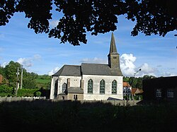
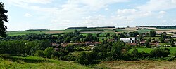
Fontaine-lès-Boulans est une commune française située dans le département du Pas-de-Calais en région Hauts-de-France. Ses habitants sont appelés les Fontainois. La commune est membre de la communauté de communes du Ternois. La commune est située à la jonction des « paysages du Ternois » et des « paysages des hauts plateaux artésiens » tels qu'ils sont définis dans l'atlas des paysages.
Gallery


Sponsored
Location
4 m
Fontaine-lès-Boulans is a commune in the Pas-de-Calais department in the Hauts-de-France region of France.
1.1 km
The Prédefin V-2 radioguidance base was a planned radioguidance base for V-2 rockets built by Nazi Germany near the village of Prédefin, approximately 16 kilometers northwest of Saint-Pol-sur-Ternoise in the Pas-de-Calais département of northern France. Constructed by the Organisation Todt, the site was intended to provide radio-based guidance and tracking capabilities for the nearby planned firing complexes at Watten and Helfaut-Wizernes, using the Leitstrahl concept, in coordination with the guidance bunker at Roquetoire. As the V-2 program evolved, fixed radio-guidance installations became operationally obsolete by early 1944 as the V-2 were equipped with an inertial platform and mobile firing stations developed. By early 1944, the Prédefin installation was transferred from the Wehrmacht to the Luftwaffe and repurposed as a radiolocation station within the regional air-defense network of northern France and as a support for the launch of V-1 flying bombs.

1.5 km
Prédefin is a commune in the Pas-de-Calais department in the Hauts-de-France region of France.
2.4 km
Heuchin is a commune in the Pas-de-Calais department in the Hauts-de-France region of France
32 miles northwest of Arras, by the banks of the Faulx river.

3.3 km
Boyaval is a commune in the Pas-de-Calais department in the Hauts-de-France region in northern France.