


The canton of Langogne is an administrative division of the Lozère department, southern France. Its borders were modified at the French canton reorganisation which came into effect in March 2015. Its seat is in Langogne. It consists of the following communes:
Location

412 m
Langogne is a commune in the Lozère department in southern France.
Located on the antique Regordane way, the Paris–Nimes railway line and the road RN 88, the city has long been a commercial crossroad between the Auvergne, the Cévennes and the Languedoc. It is one of the gateways of the historic county of Gévaudan and of the Occitanie region.
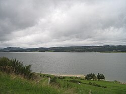
Langogne is situated in the valley of the Allier, in a mountainous area. It is crossed by the Langouyrou stream that joins the Allier in the north of the commune. The city is overlooked by hills: Margeride, Mount Milan, Bonjour Volcano.
1.6 km
Naussac is a former commune in the Lozère departement in southern France. On 1 January 2016, it was merged into the new commune of Naussac-Fontanes.

3.1 km
Lespéron is a commune in the Ardèche department in southern France.

4.6 km
Saint-Flour-de-Mercoire is a commune in the Lozère department in southern France. The Robert Louis Stevenson Trail, a popular long-distance path, runs through the village.

4.9 km
Pradelles is a commune in the Haute-Loire department in south-central France. It is a member of Les Plus Beaux Villages de France Association.
Book your tour near
Canton of Langogne
Book Now
4.2
in partnership with
GetYourGuide.com