Location Image

Bulkeley Hill Narrow Gauge Railway

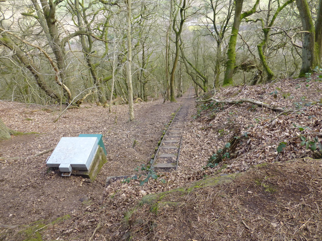
The Bulkeley Hill Narrow Gauge Railway was a 350-yard (320 m) long 2 ft (610 mm) gauge rope-hauled incline on the Bulkeley Hill near Bulkeley in Cheshire, England. With a grade of nearly 1:1 in one section, it is known as Cheshire's Steepest Railway.

Nearby Places View Menu
Location Image
808 m

Bickerton Hill

Bickerton Hill refers to two low red sandstone hills that form the southern end of the Mid Cheshire Ridge in Cheshire, north-west England. The high point, Raw Head, lies on the northerly hill and has an elevation of 227 metres. Parts of the southerly hill are also known as Larkton Hill. There is evidence of settlement on the hills dating as early as the Neolithic or Bronze Age. The earthworks of an Iron Age hill fort, Maiden Castle, are located on the summit of the southerly hill; they are a Scheduled Monument. The hills have been quarried and mined for copper since the 17th century, and a grade-II-listed engine house chimney remains as a remnant of the mining industry. Several caves occur in the sandstone, some of which have a history of habitation. The Sandstone Trail, a long-distance footpath, runs along the ridge, and the area is popular with walkers. A large area of the southerly hill is protected as a Site of Special Scientific Interest (SSSI) for its biological importance; much of this hill is owned by the National Trust. Its summit plateau has an extensive area of lowland heath, a rare habitat in Cheshire, and one that is particularly important for reptiles. A substantial population of lobed maidenhair spleenwort, a fern that is rare in Britain, is found here. Nationally scarce species observed in the area include the bleached pug and alder kitten moths, and the Malthus frontalis species of soldier beetle. The western escarpment of the northerly hill has also been designated an SSSI for its exposed Triassic sandstones.
Location Image
819 m

Bulkeley

Bulkeley () is a village and former civil parish, now in the parish of Bulkeley and Ridley, in the unitary authority area of Cheshire East and the ceremonial county of Cheshire, England. The village is on the A534 road, 9 miles (14 km) west of Nantwich. In the 2011 census it had a population of 239.
Location Image
891 m

Bulkeley Methodist Church

Bulkeley Methodist Church is in Wrexham Road in the village of Bulkeley, Cheshire, England. It is recorded in the National Heritage List for England as a designated Grade II listed building.
Location Image
917 m

Peckforton Hills

The Peckforton Hills are a sandstone ridge running broadly northeast–southwest in the west of the English county of Cheshire. They form a significant part of the longer Mid Cheshire Ridge which extends southwards from Frodsham towards Malpas. Bulkeley Hill (grid reference SJ525552) stands at the south end, and the ridge is continued southwards by Bickerton Hill. The high points are Peckforton Point (SJ529557; 203 m), immediately north of Bulkeley Hill (224m), and Stanner Nab (SJ531573; 200 m), towards the northern end of the ridge. Settlements around the hills include Burwardsley to the west, Beeston to the north, Peckforton and Bunbury to the east and Bulkeley to the south. On Ascension Day the parishioners of St Boniface, Bunbury walk to the 200m summit of Stanner Nab for a service as the sun sets.