
 English
 Français
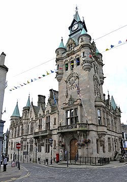
Dunfermline (district)
Dunfermline (Scottish Gaelic: Dùn Phàrlain, Scots: Dunfaurlin) was a local government district in the Fife region of Scotland from 1975 to 1996, lying to the south-west of the regional capital Glenrothes.
Nearby Places View Menu

601 m
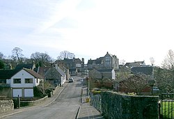
Steelend
Steelend is a former mining village in West Fife, Scotland, located on the B914 road approximately three-quarters of a mile east of the village of Saline and four miles north-west of Dunfermline. The village is home to a community centre and the Steelend Miners Welfare Club. A church was once located in the village but was demolished in the 1980s. In 1991 it had a population of 320.
The now-defunct Steelend Victoria F.C. were based at Woodside Park on the east side of the village until 2013 when the club folded due to financial issues. The name comes from a farm on Saline Hill north of Steelend.
A goods railway station once existed to the east of the village on the West of Fife Mineral Railway. The station served the several collieries that once operated nearby to Steelend, which included Sunnybraes Colliery, Saline Valley Colliery, Killernie Colliery and North Steelend Colliery.
The public transport serves the village in the form of buses which run to Dunfermline, Falkirk or Rosyth.
To the south of the village is Bandrum Hill, on top of which is a large standing stone, which are accessible from Steelend by a path. To the north of the village is the eastern end of Saline Glen, which carries the Saline Burn and a footpath which leads west into the centre of Saline.
2.2 km
Saline, Fife
Saline is a village and parish in Fife, Scotland, situated 5 miles (8.0 km) to the north-west of Dunfermline. It lies in an elevated position on the western slopes of the Cleish Hills.
At the 2001 census the population was 1188, a decline from the 1235 recorded in the 1991 census. The village has a primary school, a parish church and a golf course. The glen runs from the bottom of the main street through to neighbouring Steelend.
The civil parish has a population of 1,762 (in 2011) and an area of 8,757 acres.
The village is dominated to the east-north-east by Saline Hill, 359 meters OD, with a hill fort on the eastern summit. The smaller hill to the south of east at Bandrum has a standing stone on the peak.

2.9 km
Carnock
Carnock (Scottish Gaelic: An Ceàrnach) is a village and parish of Fife, Scotland, 4+1⁄4 miles (7 kilometres) west of Dunfermline. It is 1+1⁄4 miles (2 kilometres) east of Oakley, Fife. The civil parish had a population of 5,927 as of 2011.

3.1 km
Knockhill
Knockhill Racing Circuit is a motor racing circuit in Fife, Scotland. It opened in September 1974 and is Scotland's national motorsport centre. The circuit is in the countryside about 6-mile (9.7 km) north of Dunfermline. It is the only FIA-approved circuit in Scotland.