
 English
 Français

St John's Shopping Centre, Perth
St John's Shopping Centre is a shopping mall in Perth, Scotland. Situated between (and with entrances from) South Street (to the south), King Edward Street (to the east), Scott Street (to the west) and the pedestrianised section of the High Street (to the north), it was built between 1985 and 1987. It cost around £20 million. Its main entrance is that facing the Category B listed Perth City Hall on King Edward Street, with Perth mercat cross standing between the two. Its construction meant the ancient St John's Square was demolished, with its residents relocated elsewhere in the city. The Session House also previously stood in the market place, immediately across from the western door of St John's Kirk, on the site of today's City Hall. The shopping centre was opened in March 1988 by Dr Willi Reiland, mayor for thirty years of Perth's twin town, Aschaffenburg, Germany. The centre was once owned by Gerald Grosvenor, 6th Duke of Westminster. It was purchased by the Universities Superannuation Scheme from BAE Systems Pension Funds in 2011.
Lieux à Proximité Voir Menu

Perth mercat cross
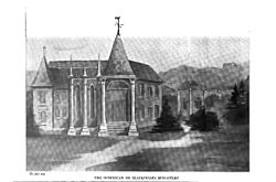
Blackfriars, Perth

Vennels of Perth
