


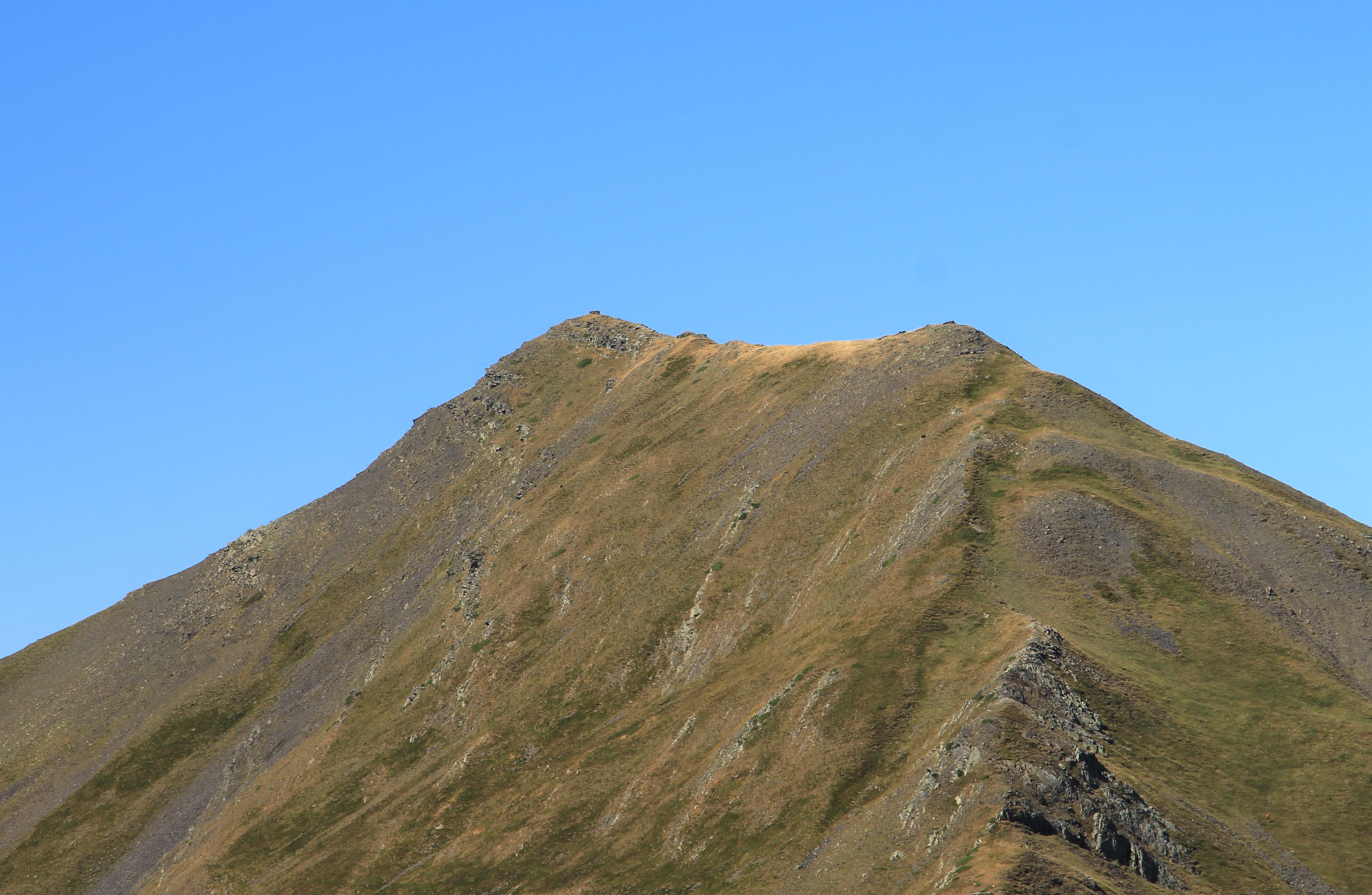
Le pic Entre les Ports (en espagnol pico del Puerto) est un sommet des Pyrénées, situé sur la frontière franco-espagnole entre les Hautes-Pyrénées, en région Occitanie, et la province de Huesca dans la communauté d'Aragon, qui culmine à 2 476 mètres d'altitude dans le massif du Vignemale.
Book your tour near
Pic Entre les Ports
Book Now
4.2
in partnership with
GetYourGuide.com
Location
1 explorer visited this place

3.0 km
Le refuge des Sarradets, or refuge de la Brèche de Roland is a mountain refuge in the Pyrenees. It is located in Gavarnie, near la brèche de Roland, in the Pyrenees National Park, at 2,587 m high.
3.2 km
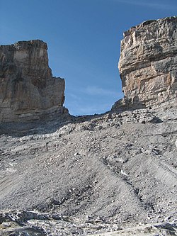
Roland's Breach is the name of a natural gap, 40 m across and 100 m high, at an elevation of 2,804 m in the Pyrenees on the border of Aragón, northern Spain, and Hautes-Pyrénées, southwestern France.
The gap is situated in the Ordesa y Monte Perdido National Park on the Franco-Spanish border, close to the steep cliffs of the Cirque de Gavarnie.
According to one legend, Roland's Breach was cut by Count Roland with his sword Durendal in an attempt to destroy the sword, after being defeated during the Battle of Roncesvalles in 778. In a variant of one of the legends associated with Salto de Roldán, a rock formation about 25 km north of Huesca, Roland, the foremost of Charlemagne's paladins, was being hotly pursued by Saracens, the Muslim Arab occupiers of Spain. Cornered at Salto de Roldán, he escaped by leaping the chasm on horseback from one of the crags to the other; the horse died in the attempt. Roland continued northward on foot, and smote the Pyrenees with his sword to create Roland's Breach, so that he could see France one last time before he died.
The provenance of this myth is unclear as the Cirque du Gavarnie is approximately 150 km East South East from the Roncesvaux Pass where the legend of Roland is based.
The gap can be reached from the Refugio Sarradets, a nearby mountain shelter, in about an hour's climb.

3.7 km
The Grotte Casteret, also known by its Spanish names Gruta de Casteret or Gruta Helada de Casteret, is a limestone ice cave, located high in the Spanish Pyrenees, within the Ordesa y Monte Perdido National Park. Discovered in 1926 by Norbert Casteret, it is known for its Grande Salle which has a frozen lake some 2,000 square metres in area, its ice formations, and a 20 metres ice wall into a second chamber.

4.9 km
The Cirque de Gavarnie is a vast cirque in the central Pyrenees, in southwestern France, close to the border of Spain. It is within the commune of Gavarnie, the department of Hautes-Pyrénées, and the Pyrénées National Park. Major features of the cirque are La Brèche de Roland and the Gavarnie Falls.
It was described by Victor Hugo as "the Colosseum of nature" due to its enormous size and horseshoe shape resembling an ancient amphitheatre. The cirque was inscribed on the UNESCO World Heritage List in 1997 as part of the Pyrénées – Mont Perdu World Heritage Site.
The cirque is 800 m wide and about 3,000 m wide at the top. The rock walls that surround it are up to 1,500 metres above the floor of the Cirque.
During the warmer seasons of spring, summer and fall, there are a number of large meltwater falls that spill into the cirque. The largest of these is Gavarnie Falls, the second-highest waterfall in Europe. It descends some 422 metres over a series of steps before reaching the floor of the cirque.
There are also several passes and clefts between the peaks that form the rim of the Cirque. The largest is La Brèche de Roland, at 2,800 metres above sea level. According to legend, its sheer walls were cut into the mountain by the sword of the hero Roland, nephew to Charlemagne.
The cirque, and many others like it in the Pyrenees, was formed by the process of glacial erosion. The Cirque de Gavarnie's uniquely immense size was likely caused by repeated cycles of glacial scraping over millions of years.
A number of rare plants and animals live on the peaks at the upper rim of the Cirque de Gavarnie, protected on both the French and the Spanish sides by national parks. Martagon lilies grow in the pine forests. Saxifraga and other tiny alpine flowers cling to the rock faces. Pyrenean chamois, a type of mammal similar to goats or antelope, live among the crags.

5.5 km
Gavarnie is a former commune in the Hautes-Pyrénées department, Southwestern France. On 1 January 2016, it was merged into the new commune of Gavarnie-Gèdre. Gavarnie is known for the Cirque de Gavarnie, and the Gavarnie Falls in it, part of the UNESCO World Heritage Site Pyrénées – Mont Perdu.
The Prime Meridian passes through Gavarnie, including at its southernmost point in France – the commune touches Aragon, Spain.
Book your tour near
Pic Entre les Ports
→
Book your tour near
Pic Entre les Ports
Book Now
4.2
in partnership with
GetYourGuide.com