
 English
 Français

Gragareth
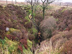
Gragareth est un sommet du Royaume-Uni culminant à 627 mètres d'altitude dans la chaîne des Pennines, dans le comté du Lancashire, dont il est le point culminant, dans le Nord de l'Angleterre. Il fait partie du parc national des Yorkshire Dales. Les versants de la montagne sont parcourus de nombreux murs en pierre sèche, marquant des limites de paroisses voire de comtés, avec le proche Yorkshire du Nord. Si la montagne est accessible en randonnée pédestre, elle fait aussi l'attrait des spéléologues en raison de ses nombreuses cavités.
Nearby Places View Menu
85 m
Gragareth
Gragareth is a mountain straddling the border between Lancashire and North Yorkshire in England. At 627 metres (2,057 ft), its summit is the second-highest point in the post-1974 county of Lancashire. The highest point in modern Lancashire is Green Hill (one metre higher), approximately 3.2 km (2.0 mi) to the north and the Old Man of Coniston in the Furness Fells of the Lake District at 803 metres (2,635 ft) is the county top of the traditional county of Lancashire. The summit of Gragareth lies about 200 m west of the county boundary, but inside the 2016 border of Yorkshire Dales National Park. The western slopes are known as Leck Fell and the southern slopes form Ireby Fell.
The summit has a trig point and extensive views towards Morecambe Bay, the Lake District fells, the Howgill Fells, Ingleborough and the Forest of Bowland. The county boundary wall running along the ridge is believed to be "one of the highest dry stone walls in the country." The Three Men of Gragareth are a group of tall cairns on the western side of the hill above Leck Fell House. Historically the hill was often called Greygarth Fell.
The fell contains several caves including Lost John's Cave, Rumbling Hole and Ireby Fell Cavern.
Wainwright includes "The ascent of Gragareth via Leck Fell returning via Ireby Fell" in his Walks in Limestone Country. His route begins at Ireby village, following a lane from Todgill Farm on the Leck road to the tarmac road which leads to Leck Fell House, then "a steep scramble" up past the Three Men. His descent route is down a long enclosure formed by the county boundary to the east and the almost-parallel boundary between Leck and Ireby parishes, dropping down Ireby Fell past the opening of Ireby Fell Cavern, to return to Ireby.

1.4 km
Jingling Pot
Jingling Pot is a limestone cave in West Kingsdale, North Yorkshire, England. Located adjacent to Jingling Beck, it is a lenticular-shaped 45-metre (148 ft) deep shaft that descends straight from the surface. At the bottom the rift extends to the north and descends steeply into a further chamber, at the end of which the initials of the original explorers may be seen scratched into the rock. A narrow shaft in this second chamber drops into a complex of small crawls and rifts, which approach close to a passage in the One-armed Bandit Series of Aquamole Pot. A second set of shafts descend parallel to the surface shaft. These can be entered through a rock window a little way below the entrance.

1.5 km
Aquamole Pot
Aquamole Pot is a limestone cave in West Kingsdale, North Yorkshire, England. It was originally discovered by cave divers who negotiated 168 metres (551 ft) of sump passage from Rowten Pot in 1974, to enter a high aven above the river passage. All subsequent major explorations were undertaken from below before an entrance was opened up from the surface. It is part of a 27-kilometre (17 mi) long cave system that drains both flanks of Kingsdale.
1.6 km
Rumbling Hole
Rumbling Hole is a cave on Leck Fell, in Lancashire, England. Its entrance is a 50-metre (160 ft) deep fenced shaft, and it rapidly descends a series of pitches to a low aqueous passage that has been connected to Lost Johns' Cave. It is part of the Three Counties System, an 87-kilometre (54 mi) cave system that spans the borders of Cumbria, Lancashire, and North Yorkshire.

1.6 km
Rowten Pot
Rowten Pot is one of several entrances into the 27-kilometre (17 mi) long cave system that drains Kingsdale in North Yorkshire, England. Its entrance is a shaft some 27 metres (89 ft) long, 10 metres (33 ft) wide, and at the southern end 72 metres (236 ft) deep.