
 English
 Français
Birdston
Birdston is a hamlet located in East Dunbartonshire, Scotland between Milton of Campsie and Kirkintilloch. The 'Campsie poet' William Muir (1766-1817) was born in Birdston and is buried in the kirkyard there. A monument to him was erected in the kirkyard by admirers of his poems in 1857.
Nearby Places View Menu

589 m
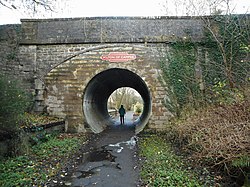
Strathkelvin Railway Path
Strathkelvin Railway Path is rail trail following the route of several dismantled railway lines extending from Gartcosh to Strathblane. It goes for 10 km from one end to another

780 m
Broomhill Hospital
Broomhill Hospital was a health facility in Kirkintilloch, East Dunbartonshire, Scotland.

852 m
Luggie Water
The Luggie Water is one of two streams which flow out of Cumbernauld. The Scottish New Town’s name derives from the Gaelic for "the meeting of the waters", which possibly refers to the Luggie Water and the Red Burn, both of which run through Cumbernauld but which never meet.
Water from the Luggie eventually ends up in the west in the Firth of Clyde via the River Kelvin which joins the Luggie at Kirkintilloch. Water from the Red Burn on the other hand flows northward and then eastward via the Bonny Water and the River Carron into the Firth of Forth. Cumbernauld can be considered the aquatic heart of Scotland, being the urban watershed between East and West in the centre of the Central Belt. Where exactly the Scottish watershed is located in the town is difficult to pinpoint. The catchment of both streams (and the River Avon) includes areas of Fannyside Muir. The Red Burn enters Cumbernauld behind Cumbernauld Academy (formerly Cumbernauld High), whereas the Luggie Water flows past Luggiebank close to the Greenfaulds railway station. Therefore, anywhere between these two landmarks may be the aquatic heart of Scotland. The Forth and Clyde Canal passes north of Cumbernauld but crosses both the Luggie Water on an aqueduct at Kirkintilloch, and the Red Burn on another aqueduct close to the Castlecary Arches.
The river levels at Condorrat (after the confluence with the Gain Burn) and Oxgang are monitored by SEPA.
For much of its length eastwards from Mollinsburn, Luggie Water formed the historic county boundary between Lanarkshire to the south and Dunbartonshire to the north.
1.1 km
Milton of Campsie railway station
Milton of Campsie railway station served the village of Milton of Campsie, in the historical county of Stirlingshire, Scotland, from 1848 to 1951 on the Campsie Branch.