


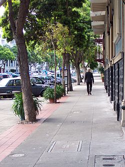
Duboce Park Landmark District is a residential section in the Duboce Triangle neighborhood in San Francisco, California. One of 12 Landmark Districts within San Francisco, it occupies 4 city blocks with 90 properties, as well as Duboce Park. It features well-preserved, Victorian- and Edwardian-era homes, many in the Queen Anne style.
Gallery


Sponsored
Location
1 explorer visited this place

69 m
Duboce and Noe station is a light rail stop on the Muni Metro N Judah line, located inside Duboce Park at the east portal of the Sunset Tunnel in San Francisco, California. The eastern portal of the Sunset Tunnel is located just west of the station. The station opened with the N Judah line on October 21, 1928.
The station has two side platforms located along the southern edge of Duboce Park with two mini-high platforms at the Sunset Tunnel portal which provide access to both lines for people with disabilities.
The stop is also served by the N Bus route which provides service along the N Judah line during the early morning when trains do not operate. Unlike all other N Judah stops and stations, the N Owl bus route does not stop at this station, instead staying on Haight Street, about two blocks away.
172 m
Scott's Pit was a lesbian biker bar in operation from 1970 until 1984 in Duboce Triangle neighborhood in San Francisco, California, U.S. This was the first lesbian biker bar in the city, and the former location has been considered an important building in LGBT history.
203 m
The Duboce Triangle is a neighborhood of San Francisco, California, located below Buena Vista Park and between the neighborhoods of the Castro/Eureka Valley, the Mission District, and the Lower Haight.
The Duboce Triangle is served by Muni Metro and buses. Because of its location east of Buena Vista Heights and Twin Peaks, the area sees less fog than many places in San Francisco.

205 m
The Wiggle is a 1-mile zig-zagging bicycle route from Market Street to Golden Gate Park in San Francisco, California, that minimizes hilly inclines for bicycle riders. Rising 120 feet, The Wiggle inclines average 3% and never exceed 6%. The path generally follows the historical route of the long since paved-over Sans Souci Valley watercourse, winding through the Lower Haight neighborhood toward the Panhandle section of Golden Gate Park.
The lower end of the route begins at either end of the Duboce Bikeway in the block of Duboce Avenue just west of Market Street. The elevation is approximately 100 feet above sea level. It then moves in a zig-zag toward the northwest along Duboce Avenue, Steiner, Waller, Pierce, Haight, Scott, and Fell Streets to the Panhandle Bikeway, 215 feet above sea level. After climbing 50 more feet, the peak of The Wiggle is reached near Stanyan Street at the peninsular drainage divide, i.e., the dividing point between surface water flowing to the San Francisco Bay on the east side and flowing to the Pacific Ocean on the west.
Bicyclists can travel The Wiggle between major eastern and central neighborhoods and major western neighborhoods.
221 m
Sans Souci Valley was the name of a valley in San Francisco, California, in the area corresponding to present day's Lower Haight and Duboce Triangle neighborhoods. This valley once allowed excess storm water to flow from Buena Vista Hill and Lone Mountain, through the Panhandle, to the area located near Duboce Park, along the path today known to cyclists as The Wiggle. The creek was not a surface creek in the dune region except as overflow. The valley’s name, French for "without worry," comes from the Sanssouci Palace built by the Prussian monarch Frederick the Great in Potsdam, Germany.
Most of the district was constructed between 1899 and 1905 by Fernando Nelson, a prolific builder known for his lively ornamentation. The district is bordered by Duboce Avenue to the south, Waller Street to the north, Scott Street to the west, and Steiner Street to the east.
See also
Duboce Park Duboce Triangle, San Francisco
Book your tour near
Duboce Park Landmark District
Book Now
4.1
in partnership with
GetYourGuide.com
