


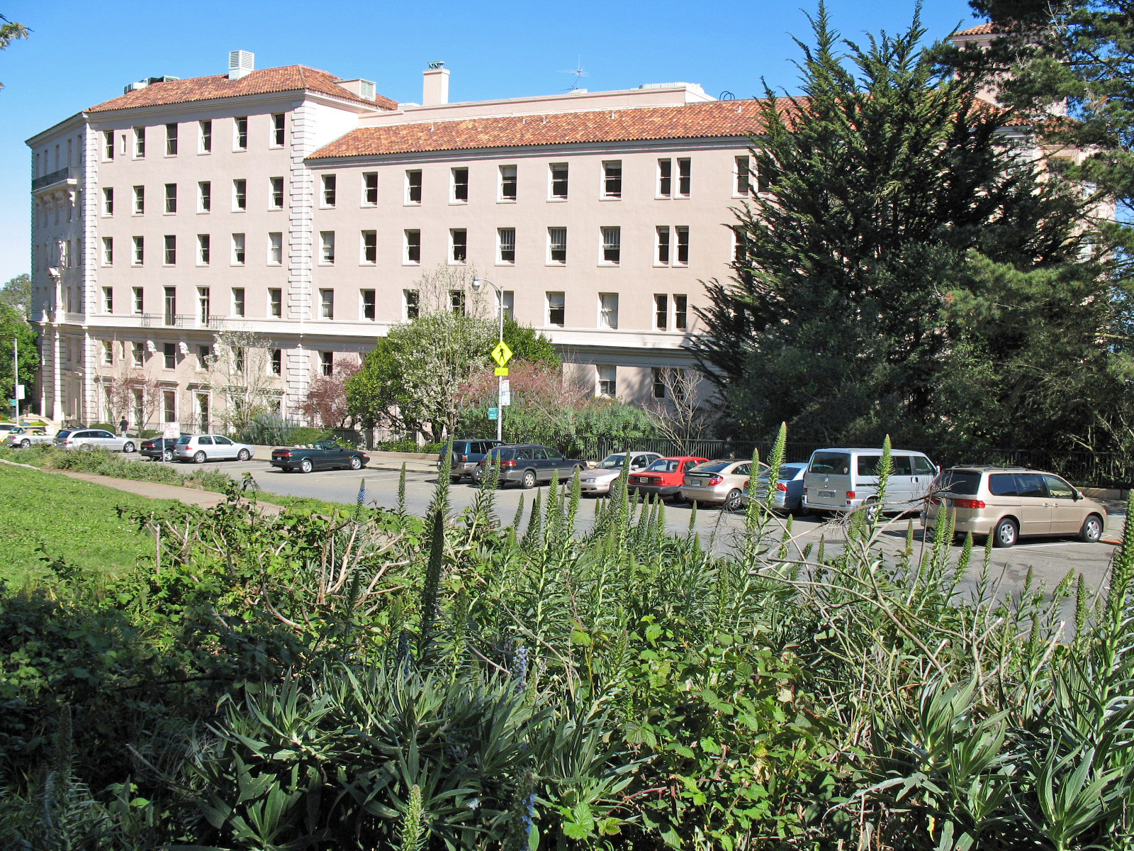
St. Joseph's Hospital is a historic building and a former church hospital, located at 355 Buena Vista Avenue East in San Francisco, California. It was built in 1928 by architects Bakewell and Brown in a Spanish Renaissance Revival style. It was added to the National Register of Historic Places on May 9, 1985.
Gallery

Sponsored
Location
1 explorer visited this place

212 m
Buena Vista Park is a public park in the Haight-Ashbury and Buena Vista Heights neighborhoods of San Francisco, California. It is the oldest official park in San Francisco, established in 1867 as Hill Park, later renamed Buena Vista. It is bounded by Haight Street to the north, and by Buena Vista Avenue West and Buena Vista Avenue East. The park is on a steep hill that peaks at 575 feet, and covers 38.3-acre. The lowest section is the north end along Haight.
304 m
Rancho San Miguel was a 4,443-acre Mexican land grant in present-day San Francisco County, California. The land grant was given in 1845 by Governor Pío Pico to José de Jesús Noé. It included what is now known as Eureka Valley, and extended past Mount Davidson almost to present-day Daly City; it encompassed the present-day San Francisco neighborhoods of Noe Valley, the Castro, Glen Park, Diamond Heights and St. Francis Wood.

320 m
Corona Heights Park is a public park in the Castro and Corona Heights neighborhoods of San Francisco, California, United States. It is situated immediately to the south of Buena Vista Park. Corona Heights is 13.2-acre and is bounded in part by Flint Street on the east, Roosevelt Way to the north, and 16th Street to the south. The base of the hill is at approximately 300 feet, while the peak extends to 520 feet above sea level.
Corona Heights Playground and the Randall Museum are located within the Corona Heights Park. The whole area is underlain by Franciscan chert bedrock, and a large percentage of the hill is barren. At the hilltop, the chert bedrock in terra cotta red is clearly visible. The steps leading up to the peak are not supported by handrails. The peak of the hill is windy, but it offers an unobstructed panoramic view of the city of San Francisco from downtown to the Twin Peaks.
349 m
The Randall Museum is a museum in central San Francisco, California, owned and operated by the San Francisco Recreation & Parks Department with the support of the Randall Friends. The museum focuses on science, nature and the arts. On exhibit are live native animals and interactive displays about nature. Other facilities include a theater, a wood shop, and art and ceramics studios.
Its permanent location is in Corona Heights Park, on a large hill between the Castro and Haight-Ashbury districts of San Francisco. The Corona Heights location features views of the city, downtown financial district and the San Francisco Bay.

481 m
Duboce and Noe station is a light rail stop on the Muni Metro N Judah line, located inside Duboce Park at the east portal of the Sunset Tunnel in San Francisco, California. The eastern portal of the Sunset Tunnel is located just west of the station. The station opened with the N Judah line on October 21, 1928.
The station has two side platforms located along the southern edge of Duboce Park with two mini-high platforms at the Sunset Tunnel portal which provide access to both lines for people with disabilities.
The stop is also served by the N Bus route which provides service along the N Judah line during the early morning when trains do not operate. Unlike all other N Judah stops and stations, the N Owl bus route does not stop at this station, instead staying on Haight Street, about two blocks away.
Book your tour near
St. Joseph's Hospital
Book Now
4.4
in partnership with
GetYourGuide.com
Book your tour near
St. Joseph's Hospital
Book Now
4.4
in partnership with
GetYourGuide.com