
 English
 Français

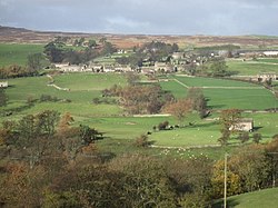
Gammersgill
Gammersgill is a hamlet in Coverdale in the Yorkshire Dales, North Yorkshire, England. It is about 7 miles (11 km) south-west of Leyburn. The toponym is of Old Norse origin, from Gamall, a personal name, and skali 'hut', so means 'hut of a man named Gamel'. From 1974 to 2023 it was part of the district of Richmondshire, it is now administered by the unitary North Yorkshire Council.
Nearby Places View Menu
1.3 km
Coverdale, North Yorkshire
Coverdale is a dale in the far east of the Yorkshire Dales, North Yorkshire, England. It takes its name from the River Cover, a tributary of the River Ure. The dale runs south-west from the eastern end of Wensleydale to the dale head at a pass, known as Park Rash Pass, between Great Whernside to the south and Buckden Pike to the north. It is accessible by a single track road, which runs the length of the dale and over the pass to Kettlewell in Wharfedale. The name is taken from that of the River Cover, which is of Brittonic origin. Ekwall suggested that it might mean "hollow stream", but more recently Andrew Breeze has argued that it is cognate with Welsh gofer "streamlet".

1.8 km
Horsehouse
Horsehouse is a village in Coverdale in the Yorkshire Dales, North Yorkshire, England. It is listed as a hamlet in many texts, but the presence of the church makes it a village. The River Cover runs near the village, and it lies some 6 miles (9.7 km) and 8.5 miles (13.7 km) south-west of Middleham and Leyburn respectively, at an elevation of 820 feet (250 m).
Most of the settlements in Highdale (the parish that Horsehouse is within), were first described in the 13th century, but Horsehouse was not recorded until the 15th century. The village is so named because it provided facilities for horses using the packhorse routes that crossed in the village. One route crossed over into Wharfedale, which is the route that still exists into Kettlewell over Park Rash.
Horsehouse was historically in the wapentake of Hang West, the chapelry of Coverham and in the Leyburn Rural District. From 1974 to 2023 it was part of the district of Richmondshire, it is now administered by the unitary North Yorkshire Council.
The village is home to St Botolph's Church, a Grade II listed building rebuilt between 1867 and 1869, and the Thwaite Arms public house, built in 1808. St Botolph's was recorded in an indenture of 1530 from Coverham Abbey, stating a canon would officiate at the church. It had existed before this time, but it is unknown for how long. There are five dedications to St Botolph in Yorkshire. St Botolph became the patron saint of boundaries, travel and trade, so it is thought the church dedication reflects the previous trades of the packhorse routes. A Wesleyan Methodist chapel was erected in the Horsehouse in 1828, and the communities of the Wesleyan's and the Primitive Methodists reunited in 1933. The chapel at Horsehouse is now a private dwelling.

1.9 km
West Scrafton
West Scrafton is a village and civil parish in Coverdale in the Yorkshire Dales, England. It is located 4 miles (6.4 km) south west of Leyburn. The population was estimated at 70 in 2013.
The village lies on the south bank of the River Cover. The parish extends 2.5 miles (4 km) south of the village, rising over West Scrafton Moor to the peak of Great Haw.
West Scrafton has featured several times in the British television series All Creatures Great and Small, in the episodes "A New Chapter" and "Alarms & Excursions". It is also where James Herriot, whose books were the inspiration for the series, holidayed with his wife, Joan.
Scrafton was mentioned in the Domesday Book. The name is Old English, from scræf and tūn, meaning "settlement at the hollow". By 1286 Scrafton had been divided into East Scrafton and West Scrafton. East Scrafton was the smaller place, and is now a hamlet in the neighbouring civil parish of Caldbergh with East Scrafton.
In the Middle Ages West Scrafton was a vill held by the Abbot of Coverham. It was historically a township in the large ancient parish of Coverham in the North Riding of Yorkshire, and became a separate civil parish in 1866. In 1974 it was transferred to the new county of North Yorkshire. From 1974 to 2023 it was part of the district of Richmondshire, it is now administered by the unitary North Yorkshire Council.
In the 19th century a small coal mine, the West Scrafton Colliery, was worked on the moorland 1.5 miles (2.4 km) south of the village. It was abandoned in 1914.

1.9 km
St Botolph's Church, Horsehouse
St Botolph's Church is an Anglican church in Horsehouse, a village in Coverdale in North Yorkshire, in England.
The first chapel in the village was built in about 1530, and was served by the canons of Coverham Abbey. Following the Dissolution of the Monasteries, it became a chapel of ease to Holy Trinity Church, Coverham. In 1859 it was described as "ancient" but "small". It was rebuilt in 1869, possibly incorporating some material from the original chapel. It was Grade II listed in 1988.
The church is built of stone with a stone slate roof, and consists of a nave and a chancel under one roof, a south porch, and a west tower. The tower has three stages, quoins, stepped angle buttresses, two-light bell openings with Y-tracery and hood moulds, a string course, and an embattled parapet. The porch has quoins, and contains a pointed arch with a chamfered surround and a hood mould. There are a variety of windows in the Gothic style, including a three-light window at the east end.