


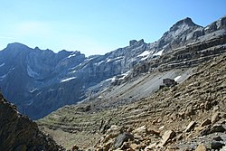
La tour du Marboré ou tour de Gavarnie est un sommet des Pyrénées situé sur la crête frontière franco-espagnole dans le massif du Mont-Perdu.
Gallery


Sponsored
Location

1.2 km
The Grotte Casteret, also known by its Spanish names Gruta de Casteret or Gruta Helada de Casteret, is a limestone ice cave, located high in the Spanish Pyrenees, within the Ordesa y Monte Perdido National Park. Discovered in 1926 by Norbert Casteret, it is known for its Grande Salle which has a frozen lake some 2,000 square metres in area, its ice formations, and a 20 metres ice wall into a second chamber.

1.4 km
The Gavarnie Falls is a tiered waterfall in France. With its overall drop of 422 metres, it is the highest waterfall in mainland France. The falls are situated in the Cirque de Gavarnie, near the village Gavarnie in the Hautes-Pyrénées.
The waterfall is the beginning of the Gave de Pau stream. It is fed by a melting snow and a small glacier, located in Spain. This water seeps underground until it appears at the upper rim of waterfall. The average annual flow in the waterfall is 3 m3/s. In summer, when the snowmelt is most intense, it can reach up to 200 m3/s. In winter it sometimes freezes and stops flowing.
The waterfall has 2 - 3 steps; the height of the tallest drop is 281 m.
1.4 km
Épaule du Marboré is a pyrenean summit, culminating at 3,073 m in the Monte Perdido Range, marking the Franco-Spanish border. It lies on the Greenwich meridien.

1.4 km
The Pyrénées – Mont Perdu World Heritage Site is a World Heritage Site straddling the border between Spain and France in the Pyrenees mountain chain. The summit of Monte Perdido is on the Spanish side of the border. The site was designated in 1997 and extended north in 1999 to include the Commune of Gèdre in France.
The site includes two bordering national parks: the entire Ordesa y Monte Perdido National Park in Spain and the eastern part of Pyrénées Occidentales National Park in France.
The World Heritage Site comprises a total area of 30,639 hectares.
1.5 km
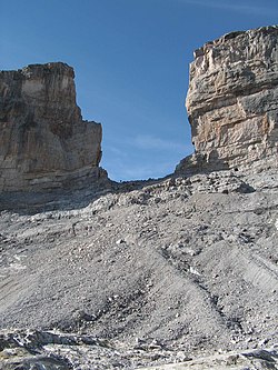
Roland's Breach is the name of a natural gap, 40 m across and 100 m high, at an elevation of 2,804 m in the Pyrenees on the border of Aragón, northern Spain, and Hautes-Pyrénées, southwestern France.
The gap is situated in the Ordesa y Monte Perdido National Park on the Franco-Spanish border, close to the steep cliffs of the Cirque de Gavarnie.
According to one legend, Roland's Breach was cut by Count Roland with his sword Durendal in an attempt to destroy the sword, after being defeated during the Battle of Roncesvalles in 778. In a variant of one of the legends associated with Salto de Roldán, a rock formation about 25 km north of Huesca, Roland, the foremost of Charlemagne's paladins, was being hotly pursued by Saracens, the Muslim Arab occupiers of Spain. Cornered at Salto de Roldán, he escaped by leaping the chasm on horseback from one of the crags to the other; the horse died in the attempt. Roland continued northward on foot, and smote the Pyrenees with his sword to create Roland's Breach, so that he could see France one last time before he died.
The provenance of this myth is unclear as the Cirque du Gavarnie is approximately 150 km East South East from the Roncesvaux Pass where the legend of Roland is based.
The gap can be reached from the Refugio Sarradets, a nearby mountain shelter, in about an hour's climb.