


Dale Castle is a 13th-century castle located close to the village of Dale in Pembrokeshire, Wales. In 1910, part of the castle was removed and other parts were incorporated into a new private dwelling house, built in the style of a fortified manor house.
Location

581 m
Dale is a small village and community in Pembrokeshire, Wales, located on the peninsula which forms the northern side of the entrance to the Milford Haven Waterway. The village has 205 inhabitants according to the 2001 census, increasing to 225 at the 2011 Census.

1.3 km
Royal Naval Air Station Dale is a former Royal Navy Naval Air Station, located 10 miles South West of Haverfordwest in Pembrokeshire, Wales. It was operational between 1942 and 1948, being used by both the Royal Air Force and the Royal Navy.
The village of Dale in Pembrokeshire is situated 0.5 miles south-east of the airfield, which itself lies adjacent to the coast, 2 miles north of St. Ann's Head, the western entrance to the Milford Haven waterway. The town of Milford Haven lies 5 miles east and Pembroke Dock lies 11 miles south-east. Notable landmarks are St. Anne's Head and Milford Haven, with Skomer Island lying 3.5 miles north-west and the small island of Skokholm lying 2.5 miles south-west.
1.8 km
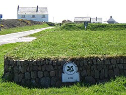
HMS Harrier was a shore establishment of the Royal Navy, located at Kete, Pembrokeshire. It was commissioned on 1 February 1948 and was the home of the RN School of Aircraft Direction from the end of the Second World War, opened on 1 January 1945, until 1961, when the Aircraft Direction Officer Training returned to RNAS Yeovilton. The site at Kete was ideal for air interception exercises, with the centre located 1 mile South of RNAS Dale, from where the live interception flights were provided from, and it had a wide sector over the sea.
The Aircraft Direction Centre was situated on the coast 0.5 miles South East of the village of Dale and 0.25 miles North of St. Anne's Head, the Western entrance point of Milford Haven waterway. The town of Milford Haven lies 5 miles East, with Haverfordwest lying 11 miles North East and Pembroke Dock lying 10 miles South East.

1.8 km
Dale Fort is a mid-19th-century coastal artillery fort at Dale Head, a rocky promontory near Dale, Pembrokeshire, west of Milford Haven in Wales. It is one of the centres run by Field Studies Council and offers residential and non-residential fieldwork for schools, colleges and universities, holiday accommodation and professional and leisure courses in natural history and arts.
2.0 km
Watwick Point Beacon is a leading light, which is a type of lighthouse, located near Dale, Pembrokeshire, in Wales. It is designed to lead ships into Milford Haven in conjunction with the West Blockhouse Point Beacons. It is situated about half a mile to the north-east of West Blockhouse Point.
Watwick Point Beacon comprises a circular pinkish-white tower. A large board at the top of the tower contains a vertical black and white daymark. The mains-powered single-beam light is mounted on a gallery on top of the tower and gives out a flashing white light which is visible for 15 nautical miles. The height of the tower is 159 feet and the light shines out at this height.