
 English
 Français

Riggend
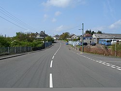
Riggend is a hamlet in North Lanarkshire, Scotland. It is on the A73 Stirling Road not far from Wattston.
Nearby Places View Menu

1.2 km
Wattston
Wattston is a village on the B803, west of Greengairs in North Lanarkshire, Scotland. Between them Wattston and Greengairs have about 1,190 residents. It is around 4 km south of Cumbernauld, and 4 km north of Airdrie. Other places nearby include Caldercruix, Longriggend, Riggend and Slamannan.
There is still open cast mining in this former mining village. The village was badly affected by the Stanrigg Mining Disaster where, in July 1918, a collapse led to the deaths of 19 local mine workers, 3 of whom were from Wattston and 6 others from nearby Greengairs.
The 98th corps of the Lanarkshire Rifle Volunteers was headquartered at Wattston.

2.2 km
Stand, North Lanarkshire
Stand is a hamlet in North Lanarkshire, Scotland situated on the A73 near Airdrie. Its Ordnance Survey grid reference is NS7668.
The village appeared on a map by Timothy Pont, published in 1596. It is near the top right of the map near the Black Loch.
Stand is also shown on another map by Roy c1754. The etymology of the name is uncertain although a horse stop or stabling point has been suggested. It is between the Fleming estates at Biggar and Cumbernauld.
2.3 km
Greengairs
Greengairs is a village in North Lanarkshire, Scotland.
Greengairs is shown on a map by Roy c.1754 under the name of Green Geirs. In toponymy, the name means "green strips of grass".
Lying 3 miles (5 km) southeast of Cumbernauld and 3 miles (5 km) north east of Airdrie, the village consists mainly of local authority housing. Between them Greengairs and Wattston have about 1,190 residents.
It developed in the nineteenth century due to increased coal mining and quarrying. Ironstone was first mined by the Summerlee Iron Company in the 1840s. It was in the parish of New Monkland or East Monkland. It also historically had its own school; the teachers had a house but no salary. The village was badly affected by the Stanrigg Mining Disaster where, in July 1918, a collapse led to the deaths of 19 miners, 6 of whom came from Greengairs.
Greengairs power station opened in 1996, and is powered by methane produced by biodegrading materials from a large landfill site developed since 1990 in former open cast workings situated to the south of the village. Greengairs is the largest landfill site in Scotland, handling waste from Glasgow and Edinburgh. Greengairs has 6000m of pipes with biogas fed by 90 gas wells.

2.4 km
Luggiebank
Luggiebank is a small village to the south of Cumbernauld. Like Condorrat, Castlecary and Dullatur, it predates the new town of Cumbernauld, and of those, only Condorrat was officially included in the designated area. It is situated on what used to be the Stirling Road from Lanark, but as a result of a bypass (B8039) the old road is now a cul-de-sac. Unlike the rest of Cumbernauld, which was in Dunbartonshire, Luggiebank was historically in Lanarkshire, but was adopted into Dunbartonshire in 1967, prior to Cumbernauld becoming a police burgh the following year. Following further boundary changes in 1995, Luggiebank became part of North Lanarkshire.
The village consists of around 30 houses and is essentially built around two streets: the older part of Stirling Road and newer houses on Blairlinn View, named after the farmsteads of Wester, Mid and Easter Blairlinn. Other farms and houses in the surrounding area are deemed to be in Luggiebank. On the south bound side of Stirling Road the houses back onto Luggie Water. The associated glen is now a nature reserve managed by the Scottish Wildlife Trust. The name comes from a cottage of that name which appears on the first Edition of the Ordnance Survey.
In a Scots dictionary, luggie can mean a wooden bucket with handles. An extract from the Ordnance Gazetteer of Scotland 1882 describes The Luggie in less than glowing terms. Two poems by Victorian poet David Gray fondly reminisce upon The Luggie: 'The Dear Old Toiling One' and 'The Luggie'.
The historical village houses are displayed on the north bound side of Stirling Road in the 1864 Ordnance Survey map. People used to go on holiday in the village and there is a postcard looking south, showing the village possibly from the 1930s. The Luggie Bridge, just to the north of the village, is a stone arch that now forms part of the foot way north out of the village.