


Aunby is a village in the civil parish of Careby Aunby and Holywell, in the South Kesteven district of Lincolnshire, England. It is situated north from Stamford on the B1176 road, and just south of Careby. In 1921 the parish had a population of 42. Aunby was formerly in the parish of Castle Bytham, in 1866 Aunby became a separate civil parish, on 1 April 1931 the parish was abolished to form "Careby, Aunby and Holywell".
Location
1 explorer visited this place

879 m
Ryhall Pasture and Little Warren Verges is a 6.2-hectare biological Site of Special Scientific Interest north of the village of Ryhall. Little Warren Verges is in Lincolnshire and Ryhall Pasture is in Rutland.
The main grasses on Ryhall Pasture are tor-grass, upright brome and red fescue. The soil is on Jurassic Upper Lincolnshire Limestone, and the rich herb flora include clustered bellflower and greater knapweed. The roadside verges have a diverse calcareous flora, and adjacent hedges are rich in herbs and insect species.
There is public access to the verges but not to the meadow.

1.3 km
Careby Aunby and Holywell is a civil parish in the district of South Kesteven, south-west Lincolnshire, in England. It stretches from the county border with Rutland in the west to the River West Glen in the east. The B1176 road from Corby Glen passes through Careby and on past Aunby toward Stamford. The main London to Scotland railway line passes through the parish, the line upon which Mallard took the speed record for the LNER.
The total population in the 2001 census was 146, falling marginally to 143 at the 2011 census. The population in 1801 was 65, and had risen to 133 by 1911
The centre of the parish is near grid reference TF017157

1.9 km
Newell Wood is a 33.3-hectare biological Site of Special Scientific Interest east of Pickworth in Rutland, adjacent to Lincolnshire Gate.
This acid semi-natural woodland is mainly on glacial sands and gravels, but some areas are on clays and siltstones. It is dominated by oak and birch, and ground flora includes bracken, wood sorrel and early purple orchid.
The site is private land with no public access.

1.9 km
Careby is the principal village in the civil parish of Careby Aunby and Holywell, in the South Kesteven district of Lincolnshire, England. The River West Glen flows through the parish, near Careby, forming part of the parish boundary. In 1921 the parish had a population of 116. On 1 April 1931 the parish was abolished to form "Careby, Aunby and Holywell".

2.2 km
Lincolnshire Gate is the name given to a corner in the road between Holywell, Lincolnshire and Pickworth, Rutland to the south-west of Castle Bytham, in Lincolnshire, England. It is situated approximately 5 miles north from Stamford. It describes a point where this small country road crosses the county border between Lincolnshire and Rutland, to pass between Newell Wood and Howitts Gorse. On either side are the remains of small quarries, worked from the Middle Ages till the early 20th century for building and road stone for nearby use.
Robert's Field, a 10 acres calcareous grassland nature reserve and Site of Special Scientific Interest, is 250 yards to the north.
There are no human settlements at Lincolnshire Gate.
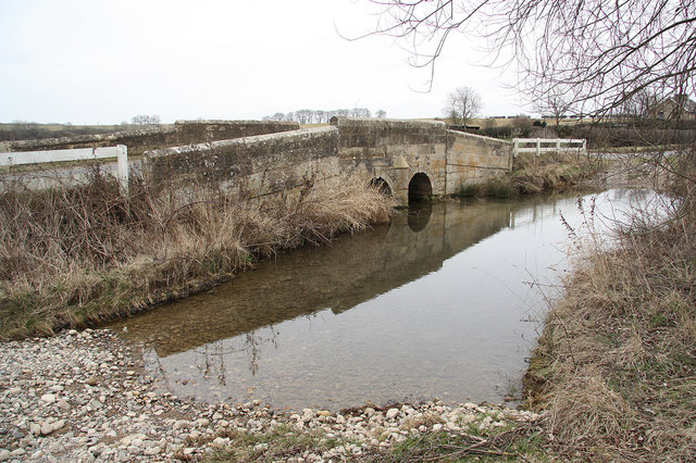
Aunby consists of Manor and Lodge farms, and a deserted medieval village. The River Glen flows to the east of the village, next to the East Coast Main Line. Close to the west is Rutland.
Book your tour near
Aunby
Book Now
4.0
in partnership with
GetYourGuide.com
