
 English
 Français

Hellaby Hall, Yorkshire
Hellaby Hall, in Hellaby, Yorkshire is a house of historical significance and is listed on the English Heritage Register. It was built in about 1688 by a wealthy English merchant and was the home to several notable residents over the next three centuries. Today it is a hotel and spa and caters for special events including weddings.
Nearby Places View Menu
312 m
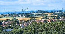
Hellaby
Hellaby is a village and civil parish in the Metropolitan Borough of Rotherham, South Yorkshire, England. The population of the civil parish at the 2011 census was 825. It is situated 5 miles (8.0 km) east from the centre of Rotherham and forms a continuous urban area with Maltby, separated from the rest of Rotherham by Junction 1 (Bramley Interchange) of the M18. It is situated by Hellaby Brook and, whilst signposted as "Hellaby Village", the parish has no school, church or post office.

1.6 km
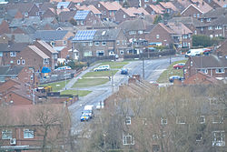
Bramley, Rotherham
Bramley is a village and civil parish of the Metropolitan Borough of Rotherham in South Yorkshire, England.
The village is situated approximately 4 miles (6 km) from central Rotherham and 8 miles (13 km) from Sheffield city centre, both to the west south-west.
Bramley is bordered by the urban development of Sunnyside conjoined to the village of Wickersley to the south, and the village of Ravenfield to the north. To the east, beyond Junction 1 of the M18, are the civil parishes of Hellaby (formerly part of Bramley) and Maltby.
The name Bramley derives from the Old English brōmlēah meaning 'broom wood or clearing'.

1.7 km
Hooton Levitt
Hooton Levitt (sometimes spelled Hooton Levett) is a village and civil parish in the Metropolitan Borough of Rotherham in South Yorkshire, England; one of four villages in the county that carry the name of Hooton, meaning 'farmstead on a spur of land'. It has a population of 110, increasing to 132 at the 2011 Census.
Hooton Levitt (or Levett) carries the manorial affix of the de Livet family, an ancient Norman family that gained control of the manor in the 12th century after marriage with the granddaughter of Richard FitzTurgis (later 'de Wickersley'), lord of the manors of Hooton and Wickersley and co-founder of nearby Roche Abbey.
It is likely that the Levetts of Yorkshire, who gave their surname to the village of Hooton, originated in Sussex, where the family had initially held land and where their holdings were in the area of Sussex controlled by the Earls Warenne, among the most powerful of the Norman nobility, who held an immense baronial holding in Yorkshire stretching to Lancashire and Cheshire. William de Livet was a witness for a deed of about 1200 in which William de Warenne, 5th Earl of Surrey, confirmed a grant to Kirklees Nunnery by Reyner le Fleming, lord of the manor of Clifton.
Samuel Lewis describes Hooton Levett in his 1848 A Topographical Dictionary of England as "a township, in the parish of Maltby, union of Rotherham, S. division of the wapentake of Strafforth and Tickhill, W. riding of York, 5¼ miles (W. S. W.) from Tickhill; containing 76 inhabitants. It derives the affix to its name from the family of Levett, who held lands here, up to about the time of Henry V. The township comprises by computation 470 acres; the soil is favourable, and the scenery pleasing."
2.0 km
Maltby, South Yorkshire
Maltby is a former mining town and civil parish in the Metropolitan Borough of Rotherham, South Yorkshire, England. It was historically in the West Riding of Yorkshire. It is located 6 miles (10 km) east of Rotherham and 10 miles (16 km) north-east of Sheffield. It forms a continuous urban area with Hellaby, separated from the rest of Rotherham by the M18 motorway. It had a population of 16,688 at the 2011 Census.