
 English
 Français

Mugdock Castle
Mugdock Castle was the stronghold of the Clan Graham from the middle of the 13th century. Its ruins are located in Mugdock Country Park, just west of the village of Mugdock in the parish of Strathblane. The castle is within the registration county of Stirlingshire, although it is only 2 kilometres (1.2 mi) north of Milngavie, East Dunbartonshire, on the northern outskirts of Greater Glasgow.
Nearby Places View Menu

499 m
Mugdock Country Park
Mugdock Country Park is a country park and historical site located partly in East Dunbartonshire and partly in Stirling, in the former county of Stirlingshire, Scotland. It is around 10 miles (16 kilometres) north of Glasgow, next to Milngavie (from which the park is easily accessible), and covers an area of 260 hectares (642 acres).
The park includes the remains of the 14th-century Mugdock Castle, stronghold of the Grahams of Montrose, and the ruins of the 19th-century Craigend Castle, a Gothic Revival mansion and former zoo. The park has a moot hill and gallowhill, historical reminders of the baronial feudal right, held by lairds, of "pit and gallows". Also located in the park are the remains of numerous anti-aircraft trenches, which were established during World War II as part of the Clyde Basin anti-aircraft defense system.
The park was also the home of the Mugstock Music Festival, at which performers have included Emma Pollock, Dodgy and Beats Antique.
Natural features include the Allander Water, Mugdock Loch and Drumclog Muir, all of which provide popular walking and cycling routes with tourists. Visitor facilities include a visitor centre and cafe in the former Craigend Castle stable block, and a garden centre and restaurant in the walled garden.
The park is served by the Mugdock and East Dunbartonshire Countryside Ranger Service.
The West Highland Way, a linear long distance footpath between Milngavie and Fort William, passes through the outer areas of the park alongside the local Clyde Coastal Path.
Close again to the country park is Milngavie water treatment works, another popular walking and tourist attraction. It is situated just south of Mugdock and connects to the park via Drumclog Moor.

838 m
Mugdock
Mugdock is a hamlet in Stirlingshire, Scotland. It lies to the south of the village of Strathblane, and was in the civil parish.
In the past the hamlet had more significance. It was considered the main village of the civil parish of Strathblane. However, since the 19th century it has shrunk down to a small collection of houses. This means that Mugdock is now a hamlet.
In the year 750 a battle was recorded in the Annals of Ulster as having taken place 'between the Picts and the Britons'. Talorgan, son of Uurgust, brother of Unust King of the Picts, died there. The battle is also recorded by the medieval Welsh text Annales Cambriae which names the battle site as Mocetauc. This is fairly plausibly explained as Mugdock, which lies roughly in the area where the ancient Pictish and Breton kingdoms must have met.
Despite being located in Stirlingshire, it has a G62 postcode.
Mugdock Country Park is located outside of the hamlet.

1.8 km
Loch Ardinning
Loch Ardinning (Scottish Gaelic: Loch Àird Dùnain) is a body of freshwater in the district of Stirling in Scotland, lying to the south of the village of Strathblane near the western end of the Campsies. The loch was increased in size by the construction of a dam in 1796; the level was further raised in 1840, and partially rebuilt in 1991. As its current extent, it covers 10 hectares.
1.8 km
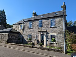
Heatherbank House
Heatherbank House is an early 19th century private house located in Milngavie, Scotland and is one of the oldest buildings in the town. It is the former site of the Heatherbank Museum of Social Work.