


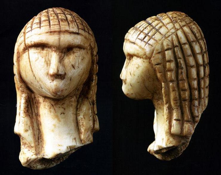
La rivière souterraine de Labouiche forme une longue cavité souterraine qui recèle un site préhistorique daté du Magdalénien. Elle est située à 6 km au nord-ouest de Foix, dans le département de l'Ariège (France). Elle se trouve sur le territoire des communes de Vernajoul et de Baulou, et dans le périmètre du Parc naturel régional des Pyrénées ariégeoises.
Gallery


Sponsored
Location
1 explorer visited this place

0 m
The Labouiche underground river forms a long underground cavity concealing a prehistoric site dating back to the Magdalenian period. It is located 6 km northwest of Foix, in Ariège, France. It lies within the municipalities of Vernajoul and Baulou, and within the perimeter of the Ariège Pyrenees Regional Natural Park.
2.4 km
Loubières is a commune in the Ariège department in southwestern France.
2.5 km
Saint-Martin-de-Caralp is a commune in the Ariège department in southwestern France.
2.8 km
Cos is a commune in the Ariège department in southwestern France.
3.0 km
Saint-Jean-de-Verges is a railway station in Saint-Jean-de-Verges, Occitanie, France. The station is on the Portet-Saint-Simon–Puigcerdà railway. The station is served by TER services operated by the SNCF.