
 English
 Français

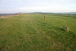
Milefortlet 23
Milefortlet 23 (Sea Brows) was a Milefortlet of the Roman Cumbrian Coast defences. These milefortlets and intervening stone watchtowers extended from the western end of Hadrian's Wall, along the Cumbrian coast and were linked by a wooden palisade. They were contemporary with defensive structures on Hadrian's Wall. There is nothing to see on the ground, but Milefortlet 23 has been located and surveyed.
Nearby Places View Menu

962 m
Alauna (Maryport)
Alauna was a castrum or fort in the Roman province of Britannia. It occupied a coastal site just north of the town of Maryport in the English county of Cumbria (formerly part of Cumberland).
It was linked by a Roman road to the Roman fort and settlement at Derventio (Papcastle) to the southeast, and thence by another road northeast to the regional hub of Luguvalium (Carlisle).
In 2015 "Maryport's Mystery Monuments" was Research Project of the Year in the British Archaeology Awards.
1.1 km
Netherhall School, Maryport
Netherhall School is a secondary school in Maryport, Cumbria. Built in the 1950s, it has a catchment area that covers Maryport, Allerby, Bullgill, Crosby, Crosby Villa, Dearham, Allonby, Flimby, Broughton Moor and other surrounding villages.
The school has a fitness gym, AstroTurf, and large sports playing fields.
1.5 km
Milefortlet 22
Milefortlet 22 (Brownrigg) was a Milefortlet of the Roman Cumbrian Coast defences. These milefortlets and intervening stone watchtowers extended from the western end of Hadrian's Wall, along the Cumbrian coast and were linked by a wooden palisade. They were contemporary with defensive structures on Hadrian's Wall. There is little to see on the ground, but Milefortlet 22 has been located and excavated.

1.7 km
Maryport
Maryport is a town and civil parish in the Cumberland district of Cumbria, England. The town is on the coast of the Solway Firth and lies at the northern end of the former Cumberland Coalfield. Maryport lies approximately 5 miles (8 km) north-west of the Lake District National Park. It includes the site of the Roman settlement of Alauna. The modern town was developed from the mid-18th century around a new harbour built at the mouth of the River Ellen. The parish also includes the village of Flimby. At the 2021 census, the built-up area had a population of 8,525, while the parish had a population of 10,865.