


St. Ann's Head Lighthouse is a lighthouse that overlooks the entrance to the Milford Haven Waterway, one of Britain's deep water harbours, from St. Ann's Head near Dale in Pembrokeshire.
Location
1 explorer visited this place
331 m
The Sea Empress oil spill occurred at the entrance to the Milford Haven Waterway in Pembrokeshire, Wales on February 15, 1996. The Sea Empress was en route to the Texaco oil refinery near Pembroke when she became grounded on mid-channel rocks at St. Ann's Head. Over the course of a week, she spilt 72,000 tons of crude oil and 480 tons of heavy fuel oil into the sea. The spill occurred within the Pembrokeshire Coast National Park – one of Europe's most important and sensitive wildlife and marine conservation areas. It was Britain's third largest oil spill and the twelfth largest in the world at the time.
Sailing against the outgoing tide and in calm conditions, at 20:07 GMT the ship was pushed off course by the current and became grounded after hitting rocks in the middle of the channel. The collision punctured her starboard hull causing oil to pour out into the sea. Tugs from Milford Haven Port Authority were sent to the scene and attempted to pull the vessel free and re-float her. Efforts were also made to offload any remaining oil from the ship but weather conditions caused delays, resulting in more spilled oil. During the initial rescue attempts, she detached several times from the tugs and grounded repeatedly – each time slicing open new sections of her hull and releasing more oil. A full scale emergency plan was activated by the authorities. News of the grounding was first reported at 21:18 on the BBC's Nine O'Clock News – just over an hour after she ran aground.
Over the next few days, efforts to pull the vessel from the rocks continued. Tugboats were drafted in from the ports of Dublin, Liverpool and Plymouth to assist with the salvage operation.
817 m
MV Sea Empress was a single-hull Suezmax oil tanker that ran aground at the entrance to the Milford Haven harbour on the southwest coast of Wales in February 1996. The ensuing oil spill, Britain's third largest oil spillage and the 12th largest in the world at the time, devastated a considerable area of local coastline and killed many birds, and continued to affect the Pembrokeshire coast for years afterwards.
1.3 km
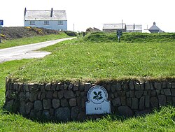
HMS Harrier was a shore establishment of the Royal Navy, located at Kete, Pembrokeshire. It was commissioned on 1 February 1948 and was the home of the RN School of Aircraft Direction from the end of the Second World War, opened on 1 January 1945, until 1961, when the Aircraft Direction Officer Training returned to RNAS Yeovilton. The site at Kete was ideal for air interception exercises, with the centre located 1 mile South of RNAS Dale, from where the live interception flights were provided from, and it had a wide sector over the sea.
The Aircraft Direction Centre was situated on the coast 0.5 miles South East of the village of Dale and 0.25 miles North of St. Anne's Head, the Western entrance point of Milford Haven waterway. The town of Milford Haven lies 5 miles East, with Haverfordwest lying 11 miles North East and Pembroke Dock lying 10 miles South East.

1.3 km
West Blockhouse Fort is a mid-19th century coastal artillery fort at West Blockhouse Point, a rocky headland near Dale, Pembrokeshire, to the west of Milford Haven in Wales.
2.2 km
Watwick Point Beacon is a leading light, which is a type of lighthouse, located near Dale, Pembrokeshire, in Wales. It is designed to lead ships into Milford Haven in conjunction with the West Blockhouse Point Beacons. It is situated about half a mile to the north-east of West Blockhouse Point.
Watwick Point Beacon comprises a circular pinkish-white tower. A large board at the top of the tower contains a vertical black and white daymark. The mains-powered single-beam light is mounted on a gallery on top of the tower and gives out a flashing white light which is visible for 15 nautical miles. The height of the tower is 159 feet and the light shines out at this height.